|
|
|
|
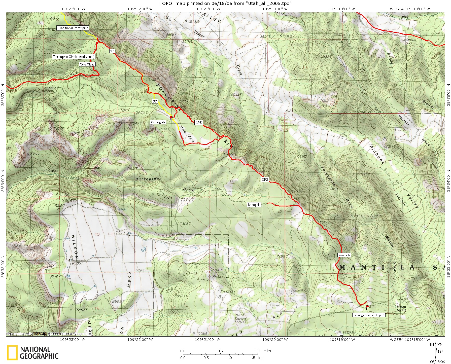
| Topo Trail Map | Map Legend | Post a Picture and view Posted Pictures Below Kokapelli - UPS - LPS - Porcupine - Porc 4x4 - Fins & things |


|
|
|
|
| Topo Trail Map | Map Legend | Post a Picture and view Posted Pictures Below Kokapelli - UPS - LPS - Porcupine - Porc 4x4 - Fins & things |
|
UT - Kokapelli DN - Upper Porcupine rim sinlgetrack, Lower Porcupine singletrack, porcupine rim Mountain Bike Trail Review with Map and Pictures |
|||||||||||||||||||||||||||||||||||||||||||||||||||||||||||||||||||||||||||||
Directions - From Moab head south on 191 for
about 8 miles and take a left on Lasal Mountain loop road. 1/2 mile in
take right at T intersection. Follow for 20 miles of winding road to
the trailhead.. Trailhead is like 50 ft BEFORE the pullout. |
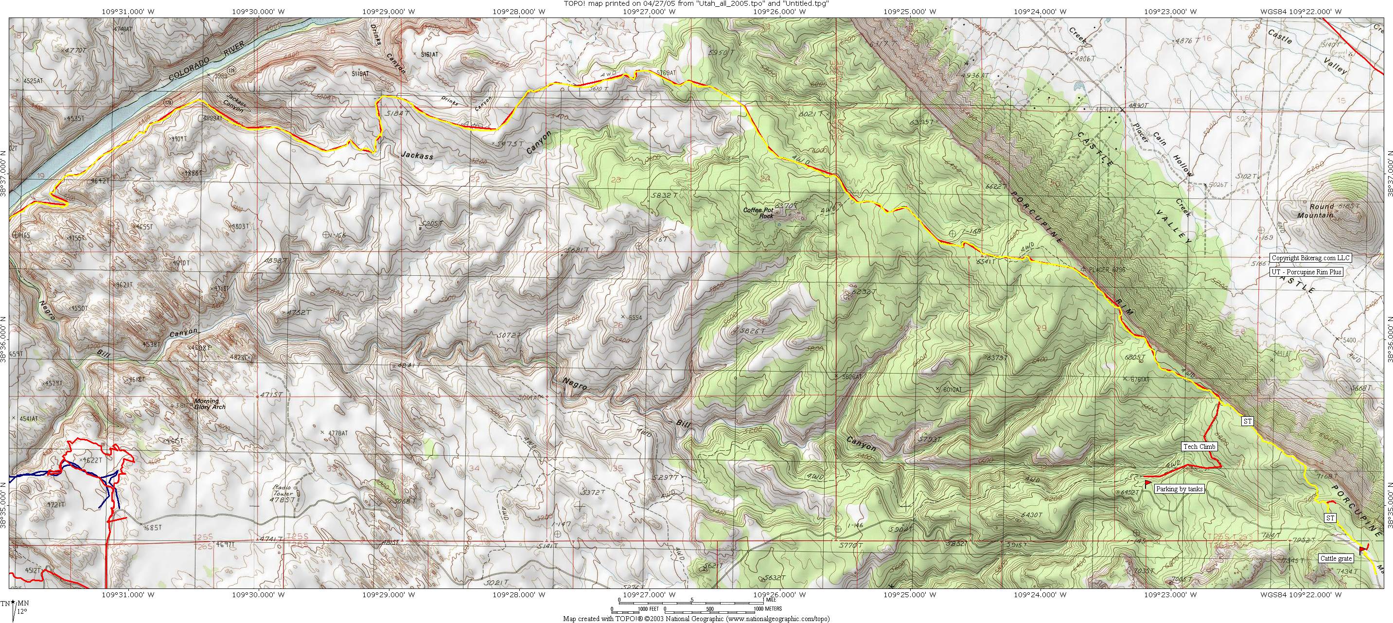
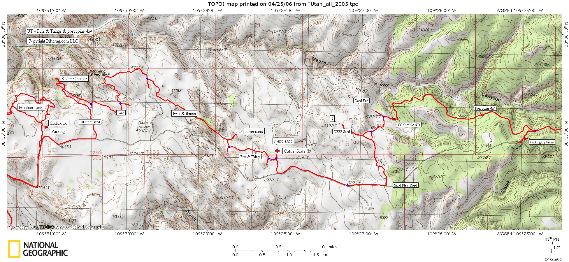
Description - You can combine the Kokapelli, UPS and LPS with traditional porcupine rim OR take a left and go DOWN the traditional procupine Climb, and link up with porcupine 4x4 and later fins and things (see fins and things review before deciding, There are large batches of un ride able SAND there).. Top of Kokapelli starts as rutted double track up in the mountains.. Look for RIGHT turn on UPS singletrack, thats where the fun starts.. UPS and LPS are just unbelievable - super nice singletrack, amazing views with some great tech's mixed in.. Few drops, rollers, riding on the edge, just awesome.. Loops - Pre-ride Music: |
Total Miles: 18 miles from Top to your hotel
in moab (SHUTTLE) |
Elevation Change Feet - 4,000 Feet |
|
Disclaimer: Caution - Use this map at your
own risk. Bikerag.com and affiliates will not accept
responsibility for an personal injury, property damage or trespassing while
using this map. Trail users shall obey all signs, and always obtain
permission from the land owner to use trails for any sporting activity.
Permission to use trails should not be assumed. This map simply
contains topographical information and trails that existed at one time.
Trails shown maybe be missing, not accurate, closed, overgrown etc.... |
To
view larger version of map, right click on map and select View Image. |
Kokapelli
Traditional Porcupine Rim
Fins & things 4x4
| ||||||||||||||||||||||||||||||||||||||||||||||||||||||||||||||||||||||