|
UT - Porcupine Rim - Mountain Bike Trail Review with Map and Pictures |
|||||||||||||||||||||||||||||||||||||||||||||||||||||||||||||||||||||||||
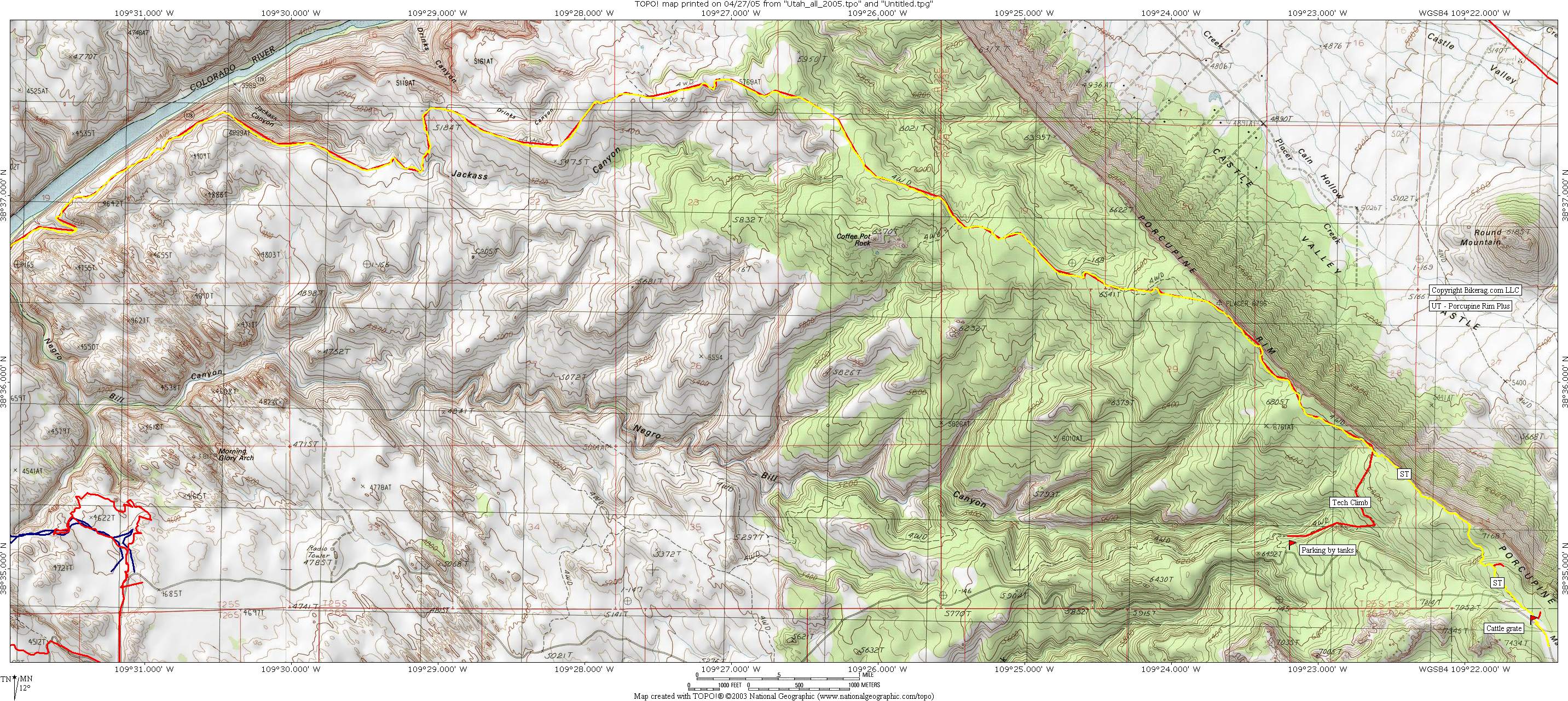
Directions - From town just go past the
slickrock trail, keep going up dirt road, till you get to the tanks and
park, or continue on up to cattle grate for extra singletrack. |
Update 2012: Nothing much new to report on the Pork. Still one of my favorite trails in moab. We did UPS to LPS to Pork and I managed to only get 4 flats. Such an awesome day, same amazing views, trail hasn't changed much at all great way to wrap up my vacation. Update - New Singletrack at the top - Follow the main road past the tanks at typical porc trailhead, up up and away.. You get to see elvis's hammer rock on the way up.. Anyway, singletrack starts on your left right near cattlegrate.. It Splits IMMEDIATELY, but both trails join up. The New singletrack is sWEET. Reminds me of hidden canyon at gooseberry or little creek mesa. One serioso hike a bike down, unless your insane ,which you are.. Nice colorful trail lined with flowers, some wicked cool techs and riding RIGHT on the RIM. Only downer is it's a bit short lived, shuttle driver said it was 6 miles, actually 1.5 !!! And you miss the climb up the porc from the tanks which is no gimme.. So I vote, be a milkman, ride the new single, then bomb back to the original trailhead, then climb back up, crap wish I did that, as OBD would say "DO IT"... Description - Epic Moab One way or loop if you have fresh legs and an early start. Start out at trailhead and climb up 1000 feet of awesome technical rocky mahem. Its so much fun you don't even realizing your climbing - Yes im a liar. Once at the top - the view of a lifetime. Onward for a long long long ass downhill. You made need to stop several times to rest your legs. Double wide, triple fast rocky stuff, pick your line, dont follow me... Really "STOP FOLLOWING ME".. Anyway, some great launches, you will find some air without looking.. Trail eventually turns to single track as it carves its way back to town overlooking the Colorado River. Single track has some great tech. sections and good views of other riders. Back to the road - Left turn road ride to bridge, another left, road ride back to town.. A ride not to miss in Moab!! Loops - Pre-ride Music: Prodigy
- Breathe |
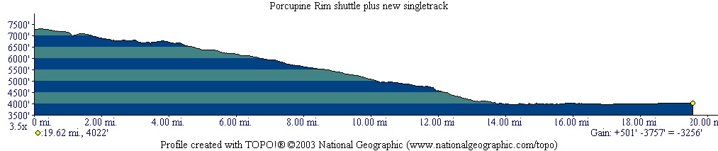
Total Miles: 20 miles, 3700 feet of
Descending (shuttle) |
|
|
To
view larger version of map, right click on map and select View Image. |
| |||||||||||||||||||||||||||||||||||||||||||||||||||||||||||||||||||