|
|
|
|
| Topo Trail Map | Map Legend | Bikerag Pictures |
|
UT - Rockville Bench - Slickrock Swamp - Mountain Bike Trail Review with Map and Pictures |
||||||||||||||||||||||||||||||||||||||||||||||||||||||||||||||||||||||||||||||||
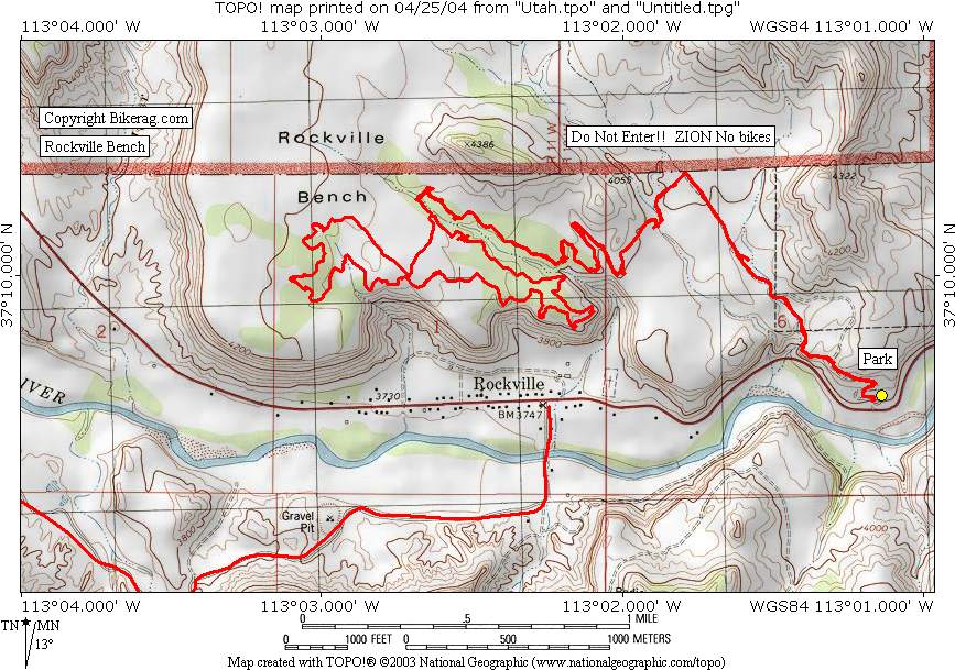
Directions - From Sprindale (flanigans inn)
Travel about 1.8 miles west and look for right on Anastazio or something
road, go up and look for sketchy dirt right that goes steep down into
parking area just above route 9.. |
Description - Great ride - Tight rocky single track, and lots of slickrock overlooking the lush town of rockville.. Can be a short local ride or longer if you like to play on rocks or with yourself.. Loops - Its a lariat, or as SSK likes to say a Popsickle or cherry stem (IE - OUt and back with loop on end. Pre-ride Music: |
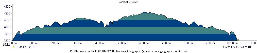
Total Miles: 10 |
|
 |
Nearest Coffee, Sushi or other food: Springdale (foot of Zion NP) Pizza Noodle 5 Stars. Good beer (Polygamy Porter).
Or OSCARS - Breaksfast!! LINNER!! |
|
|
Disclaimer: Caution - Use this map at your
own risk. Bikerag.com and affiliates will not accept
responsibility for an personal injury, property damage or trespassing while
using this map. Trail users shall obey all signs, and always obtain
permission from the land owner to use trails for any sporting activity.
Permission to use trails should not be assumed. This map simply
contains topographical information and trails that existed at one time.
Trails shown maybe be missing, not accurate, closed, overgrown etc.... |
To
view larger version of map, right click on map and select View Image. |
| ||||||||||||||||||||||||||||||||||||||||||||||||||||||||||||||||||||||