|
|
|
|
| Topo Trail Map | Map Legend | Bikerag Pictures |


|
WV - Props Run - Slatyfork - Mountain Bike Trail Review with Map and Pictures |
|||||||||||||||||||||||||||||||||||||||||||||||||||||||||||||||||||||||||||||
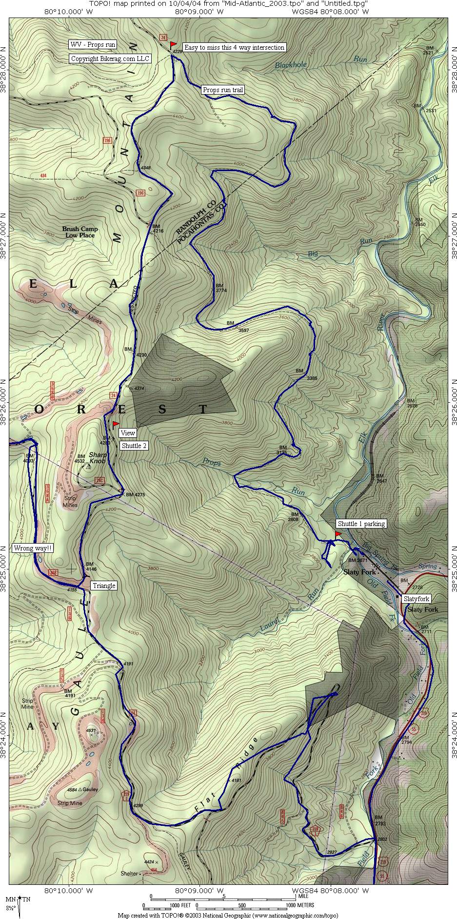
Directions - IF I told you how to get
here, you would ride here, and then curse me later.. Ok Ok take 219
south to slutyfork and take a right at lumber company, drive to end and
leave a car at the turn around.. Head back to 219 and take a right on
mine road FS 24, follow this gravel road uphill around one switchback, take
a right at triangle!!! Continue up and park - we parked at overlook
where you can see snowshoe.. |
Description - One of the most overrated rides I have hit yet. Although, it would have paid to check MTBR before riding, the review was dead nuts accurate.. Still a decent trail, just have to lower your expectations, kind of like going on a blind date. The ride, very easy singletrack that goes REAL straight.. It is located on the left side of a 13.3 foot grassy muddy bench that pitches slightly downward for like 8 miles.. You will be pedalling all the way.. Every 400 feet there is a drainage ditch to ride through.. Get your manuals down.. Couple times the trail winds up on a small ridge, and drops back down.. A few bridges and a few stream crossings give this ride a tinge of variety.. At the end, there is one big stream crossing where unless you have mad skillz (like sock stuffer) you will get wet.. We did a shuttle, with a big group and still had some fun, but the question of the hour is would I go back - Not a chance, no way, not gonna happen, nada nada limonada as my old spanish teacher used to say.. If you pedal up fs24 to ride prop's its safe to say that the rocks are not on the trail, but in your head.. I dont mind earning my vert, but please, if you pedal up to go down this you will be so disappointed, enraged, confused etc.. Dont believe the hype or any guidebook that says this ride rocks... Loops - Pre-ride Music: Dunt Dunt Dunt - another one
bites the dust - another ride bites the dust |
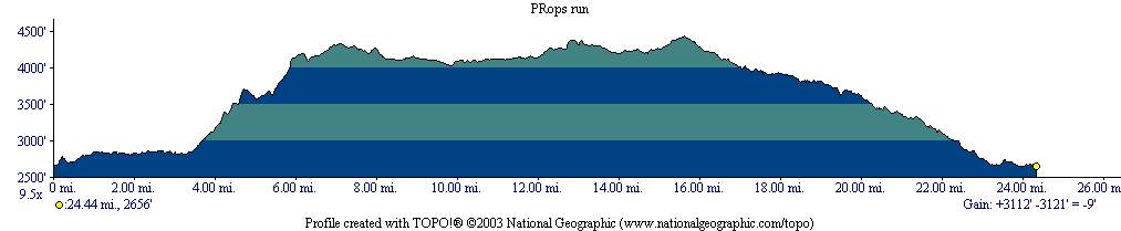
Total Miles: 22 without shuttle |
Elevation Change Feet - Includes shuttle!! And some wrong turns for
good measure |
|
Disclaimer: Caution - Use this map at your
own risk. Bikerag.com and affiliates will not accept
responsibility for an personal injury, property damage or trespassing while
using this map. Trail users shall obey all signs, and always obtain
permission from the land owner to use trails for any sporting activity.
Permission to use trails should not be assumed. This map simply
contains topographical information and trails that existed at one time.
Trails shown maybe be missing, not accurate, closed, overgrown etc.... |
To
view larger version of map, right click on map and select View Image. |
| ||||||||||||||||||||||||||||||||||||||||||||||||||||||||||||||||||||||