|
|
|
|
| Topo Trail Map | Map Legend | Bikerag Pictures - Members only |


|
VT - Saxon hill - Essex - Mountain Bike Trail Review with Map and Pictures |
|||||||||||||||||||||||||||||||||||||||||||||||||||||||||||||||||||||||||||||
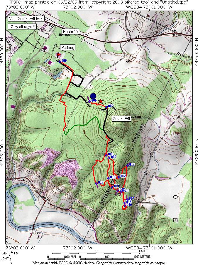
Directions - Fron essex center, take 15 east
for a short distance, look for Allen martin drive and take a right, then
second left onto Thompson drive, drive to end and park by gate. Not
allot of room for parking. |
Description - Some pretty cool riding can be found around the Saxon hill area, but be warned, I suggest you go on a group ride there, or plan on spending a little time wandering through many fire roads and doubletrack, some muddy, some grassy.. Besides that once you find the singletrack its good stuff with some moderate tech's and just a couple really cool TTF's to show your friends what a Star you are.. Hint Hint.. I didn't post any pic's but you might find them somewhere on the bikerag picture post site.. Loops - Pre-ride Music: |
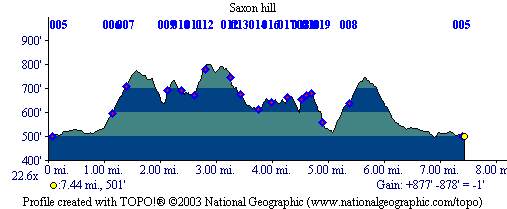
Total Miles: ?? - I found about 10, lots more |
|
|
Disclaimer: Caution - Use this map at your
own risk. Bikerag.com and affiliates will not accept
responsibility for an personal injury, property damage or trespassing while
using this map. Trail users shall obey all signs, and always obtain
permission from the land owner to use trails for any sporting activity.
Permission to use trails should not be assumed. This map simply
contains topographical information and trails that existed at one time.
Trails shown maybe be missing, not accurate, closed, overgrown etc.... |
To
view larger version of map, right click on map and select View Image. |
| ||||||||||||||||||||||||||||||||||||||||||||||||||||||||||||||||||||||