|
VA - Sherando Lake - Mountain Bike Trail Review with Map and Pictures |
|||||||||||||||||||||||||||||||||||||||||||||||||||||||||||||||||||||||||
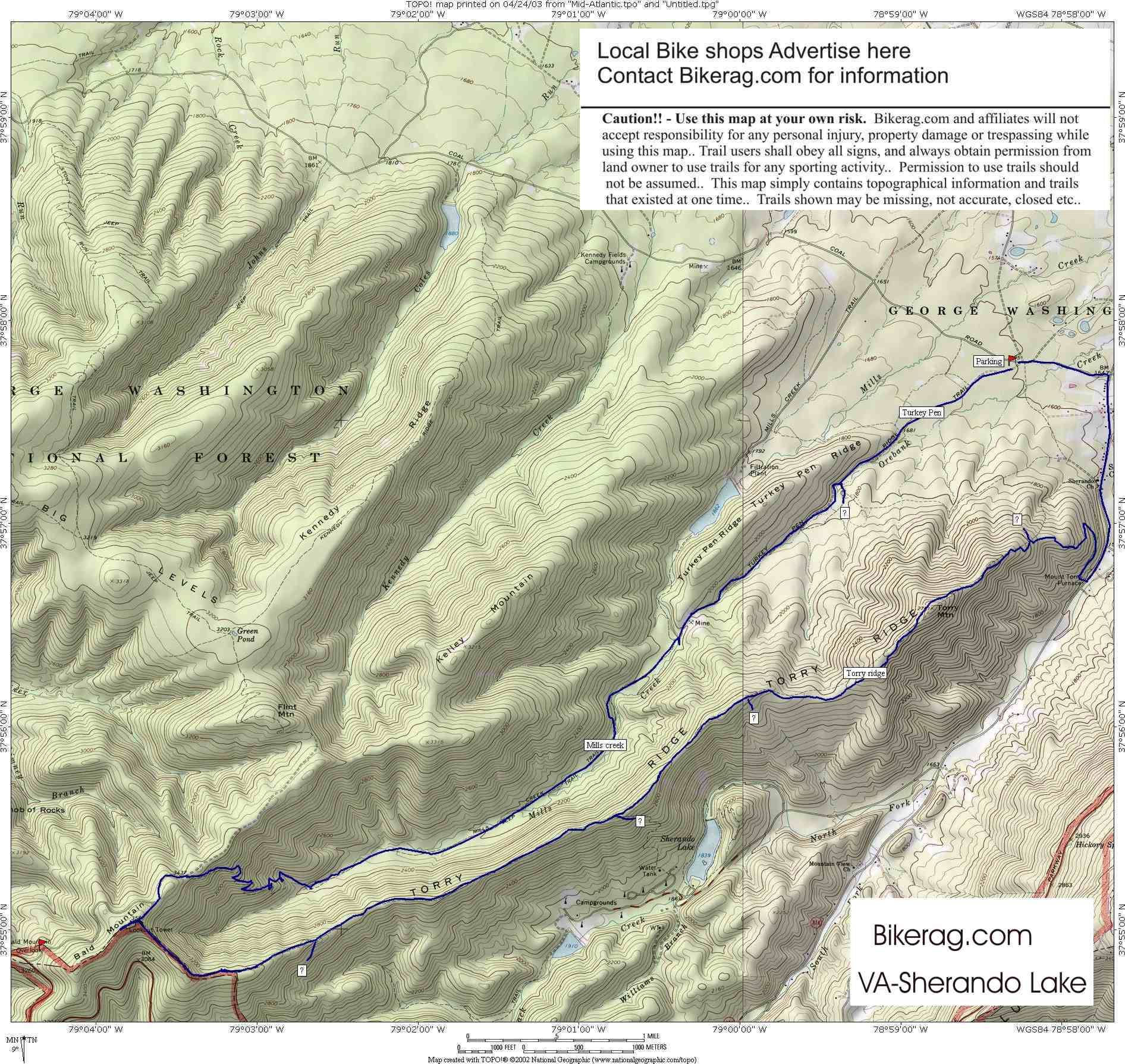
Directions - Route 64 to exit 96, follow signs
for sherando lake.. Take a right on Coal road (thats FR42), go about
.5 miles and park on left in small lot with piles of crap and feathers. |
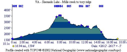
Description - Turkey pen trail was just a fire road, wide and sandy, just how we like em.. After about a mile you see boulders in front of a creek, turn right on the blue blazed mills creek trail here.. Up mills creek there is a variety of terrain, double track, grassy singletrack, rocky 1.5 track, stream crossings, log pyramids.. Some bushwacking around downed trees but not too bad.. Then the climb, basically narrow singletrack with loose stones and all rideable switchbacks. Views were pretty nice on the way up.. At the top you might see some cars parked, take a left onthe fire road, climb a bit, keep staying left and look for yellow blazed tory ridge trail on left.. Tory ridge was awesome, the trail kept changing from nice pine needle laurel engulfed singletrack to super rocky technical 1.5 ish trail.. Some gonzo rideable rock gardens. I had to walk down one section due to lack of gonadvil in my system.. There are 2 turns off the tory ridge trail we didnt take them.. Staying on the ridge does mean you have to climb a bit here and there. finall trip down was great - just one right trailhead turn and you end up at the furnace.. Great day of riding.. 1.5hours up mills creek and 2.5 hours down - make sense, probaly not - Listen to me now, believe me later.. Other Trails - Kennedy ridge trail ("its like riding on bowling balls"; see review page), White rock gap trail, jeep trail, and 2 trails off Tory Ridge I cant remember.. Loops - Turkey pen to mills creek up, Tory ridge down.. Many other trails in the area too, im coming back to check them out for sure!! Pre-ride Music: Anything
by the Rolling Stones |
Total Miles: 17 miles or so, many more in
area, probably 40 ish.. |
Elevation Change Feet -
2600 feet |
Nearest Coffee, Sushi or other food: Nearest
coffee is in ohio.. |
|
| |||||||||||||||||||||||||||||||||||||||||||||||||||||||||||||||||||


