|
|
|
|
| Topo Trail Map | Map Legend | Bikerag Pictures |


|
|
|
|
| Topo Trail Map | Map Legend | Bikerag Pictures |
|
VA - Kennedy Peak - Stephens trail - Edith gap trail - Mountain Bike Trail Review with Map and Pictures |
|||||||||||||||||||||||||||||||||||||||||||||||||||||||||||||||||||||||||||||
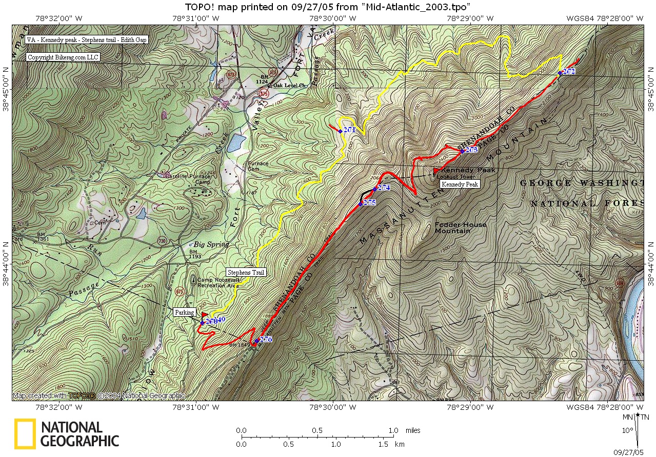
Directions - 81 to Edinburgh, 675 east follow
to camp Roosevelt. Just PAST camp Roosevelt there is a parking lot at
the Stephens trailhead on left. |
Description - Great loop that is more moderate in length and time than most rides in the area. You can choose to ride this loop either way but I suggest starting on the stephens trail and riding the loop clockwise. Stephens starts as a nice relatively flat singletrack with scattered techs here and there. Great warm-up.. Once it starts climbing its pretty relentless but mostly ride able, you may get off here and there (easy now), due to some loose rocks. Once on the ridge your still up hilling but with some great technical uphill lines to keep your mind off any leg pain.. Out and back to Kennedy some really tough uphill lines, fun as hell back down.. Once you head toward the Edith gap, trail is really cool, bench cut singletrack +, with lots of rock lines for about a mile.. Sweet section.. After you hit the switchback the trail goes tame for a bit, but you don't loose/ waste that much vert on the fire road.. The double track goes right into the switchback in the road.. DON'T TAKE THE ROAD DOWN!! take a right on the road, travel 50 FEET, take a right back on the trail, super fun technical singletrack back to the car.. If you want more miles, take a left at the top of Stephens and explore, out and back style. Not sure what you'll find, but its an out and back so no worries.. Loops -Stephens to ridge trail, to Edith gap.. Pre-ride Music: |
Total Miles: 10+ |
|

|
Disclaimer: Caution - Use this map at your
own risk. Bikerag.com and affiliates will not accept
responsibility for an personal injury, property damage or trespassing while
using this map. Trail users shall obey all signs, and always obtain
permission from the land owner to use trails for any sporting activity.
Permission to use trails should not be assumed. This map simply
contains topographical information and trails that existed at one time.
Trails shown maybe be missing, not accurate, closed, overgrown etc.... |
To
view larger version of map, right click on map and select View Image. |
| ||||||||||||||||||||||||||||||||||||||||||||||||||||||||||||||||||||||