|
|
|
|
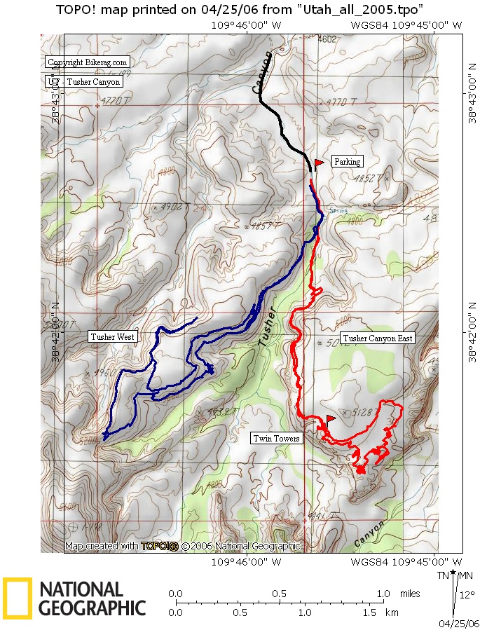
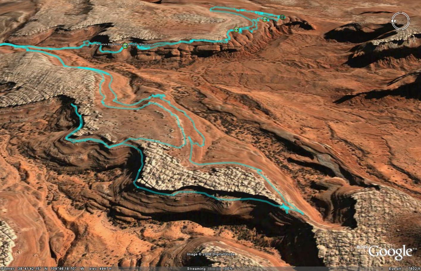
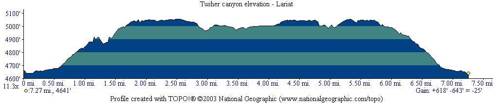
| Topo Trail Map
|
Map Legend |
Bikerag Pictures Tusher EAST Post a Picture and view Posted Pictures |


|
UT - Tusher Canyon - Moab - Mountain Bike Trail Review with Map and Pictures |
|||||||||||||||||||||||||||||||||||||||||||||||||||||||||||||||||||||||||||||
Directions - From Moab Center, drive
north about 15.5 miles and look for left on mill canyon road (trailhead for
monitor and Merrimac). Travel .61 miles and turn right. at 1.3 miles
stay left on main road. At about 2.75 miles drop into wash and fork left
twice. There will be some signs for tusher. The green road on
your right would go to bartlet.. The wash will eventually get a
little too tight to drive through, back up and park on high sandy ground,
only about 1/2 mile from trailhead. |
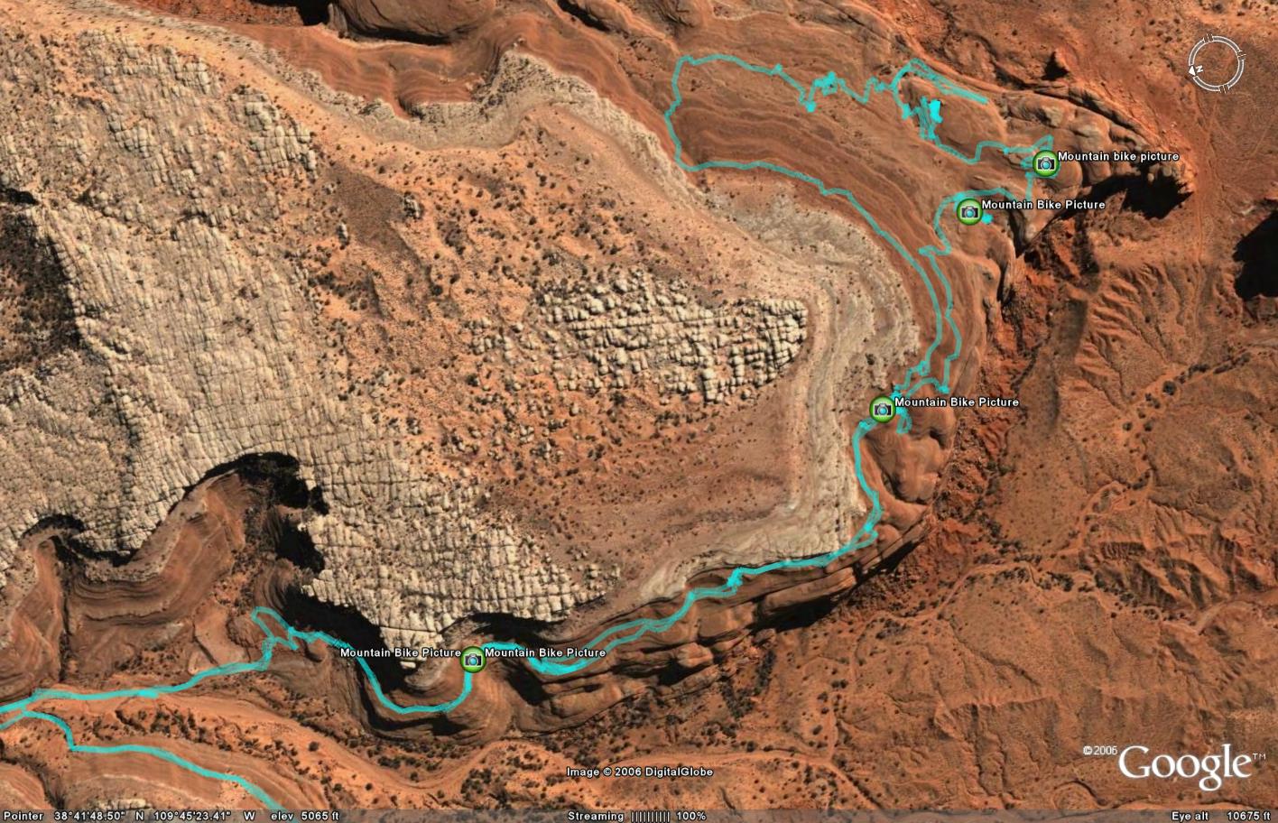
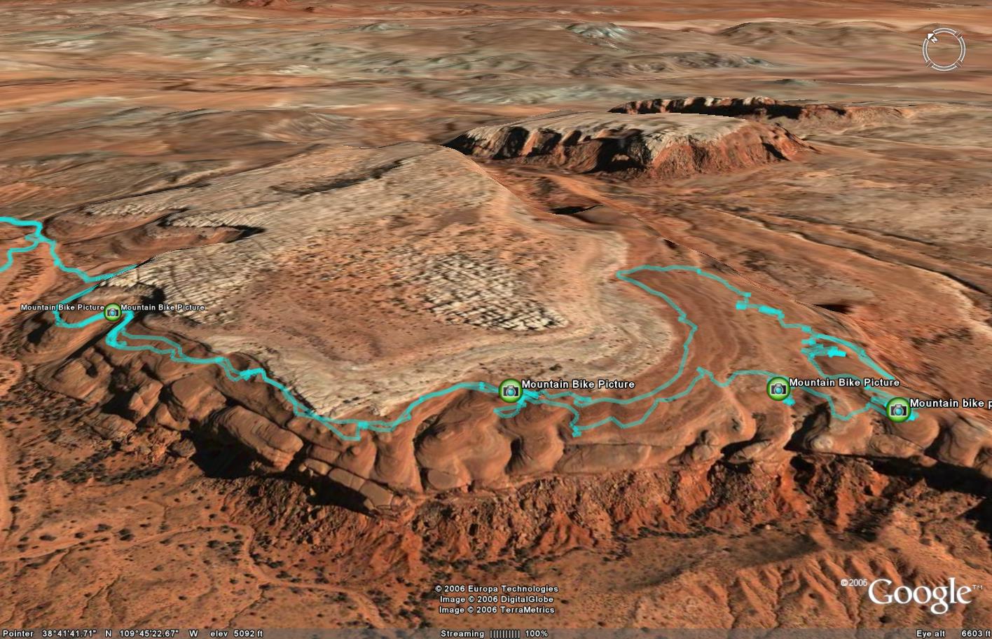
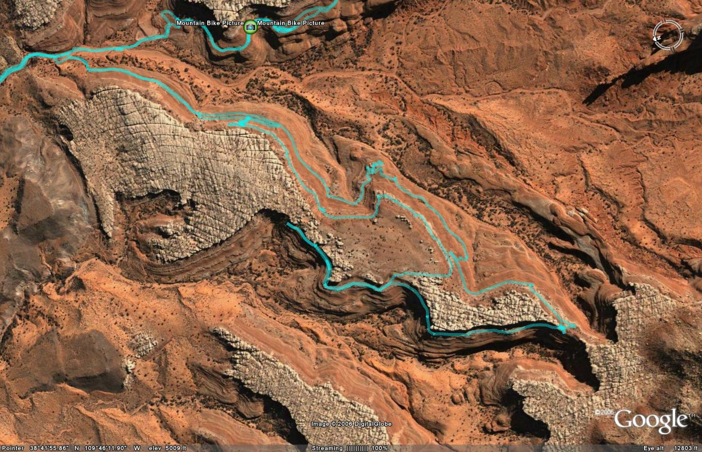
Update 2006 - Checked out Tusher Canyon West.. Very cool larait loop, not quite as cool as The east side in my opinion, but you can easily ride them both in the same day.. To get to the start, from the main road / streambed, look for right up sandy hill walk up, 50 feet or so, youll see the start. Its not marked but easy to navigate, basically just keep riding on whatever level you start on, if you get cliffed out, U-turn and look for way to get up.. Once you get around point there are some sections of singletrack, and some hike a bike sections.. Look for cutoff on right, steep hill about 30 feet high, warn in, walk to top and youll find singletrack through monoliths with scampering bunny's.. Some cool lines back home if you go upper deck there are a couple spots (expert) where you can ride down, plus maybe one dismount.. Do not ride here if there's even a chance of rain!! Description - I was intrigued by this ride due to its
similarity and promiscuity to bartlet wash - the coolest place on earth. It
was a great rest day play day with no rest. Drive in don't ride in, if you
ride, your legs will be so focking tired, you wont make it to the first
cairn. Anyway, so from the parking area, ride into the wash and follow the
strange slickrock with natural drainage trenches to your left and look for
cairns that get you up on the entrada slickrock.. Just a couple couple
carry's, then its ride time.. Not quite like bartlet in that you cant play
much on the way out to the play area since there is a cliff on your right
the whole way up.. Its not really bad except for one spot that I must say
would be more dangerous to walk than ride.. Your not that close to the edge,
but its off camber.. If anyone in your crew doesn't like heights, stick with
Bartlet wash.. Loops - There is no trail, just rock, no dots, ride what inspires you. Map shows a lariat. Pre-ride Music: Paranoise |
Total Miles: 7 |
|
|
Disclaimer: Caution - Use this map at your
own risk. Bikerag.com and affiliates will not accept
responsibility for an personal injury, property damage or trespassing while
using this map. Trail users shall obey all signs, and always obtain
permission from the land owner to use trails for any sporting activity.
Permission to use trails should not be assumed. This map simply
contains topographical information and trails that existed at one time.
Trails shown maybe be missing, not accurate, closed, overgrown etc.... |
To
view larger version of map, right click on map and select View Image. |
| ||||||||||||||||||||||||||||||||||||||||||||||||||||||||||||||||||||||