|
|
|
|
| Trail map | Map Legend |


|
Roaring Run - Apollo PA - Mountain Bike Trail Review with Map and Pictures
Very Preliminary (got rained out) |
||||||||||||||||||||||||||||||||||||||||||||||||||||
|
||||||||||||||||||||||||||||||||||||||||||||||||||||
| Local website for more updated info -
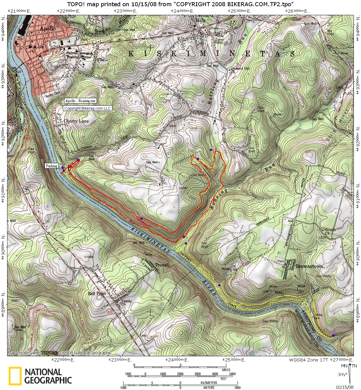
www.porcmtbclub.org Directions - Google Map Directions Description - Almost exactly 2 years ago PMD and I sat in the parking lot at Apollo in pouring rain.. So this trip we were determined to go back, just in principal. OF course Rain was in the forecast so we tried to get an early start. Figured we would start on the singletrack closest to the car (in retrospect - that was a mistake). We ended up riding the trails to the west of roaring run, which were OK, but not very well marked, nothing too special. Some nice rock work here and there but mainly pretty buff trail. We did run into a nice waterfall, and the road next to roaring run was very scenic, unfortunately that's when it started to rain so we bailed. From what I hear, the best trails are EAST of roaring run, so I didnt bother assigning a false rating to this ride.. Loops - See map below - we rode the track in red, I suggest you start with the trails to the east of roaring run shown yellow dashed. |
||||||||||||||||||||||||||||||||||||||||||||||||||||
| Pre-ride Music: Garbage - I'm only happy when it rains | ||||||||||||||||||||||||||||||||||||||||||||||||||||
| Total Miles: 12+ | ||||||||||||||||||||||||||||||||||||||||||||||||||||
| Elevation Change Feet - | ||||||||||||||||||||||||||||||||||||||||||||||||||||
|
||||||||||||||||||||||||||||||||||||||||||||||||||||
| Disclaimer: Caution - Use this map at your own risk. Bikerag.com and affiliates will not accept responsibility for an personal injury, property damage or trespassing while using this map. Trail users shall obey all signs, and always obtain permission from the land owner to use trails for any sporting activity. Permission to use trails should not be assumed. This map simply contains topographical information and trails that existed at one time. Trails shown maybe be missing, not accurate, closed, overgrown etc.... | ||||||||||||||||||||||||||||||||||||||||||||||||||||
| To
view larger version of map, right click on map and select View Image.
|
||||||||||||||||||||||||||||||||||||||||||||||||||||