


|
PA - American Standard - Jim Thorpw - Mountain Bike Trail Review with Map and Pictures |
|||||||||||||||||||||||||||||||||||||||||||||||||||||||||||||||||||||||||
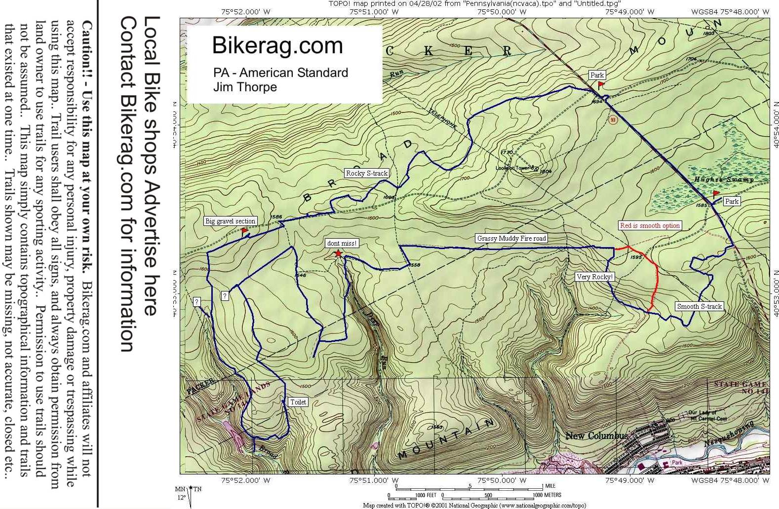
Directions - From Jim Thorpe, 209 north,
take a right on 93 and follow for 2.4 miles, park in dirt lot on right.
Trailhead starts at truck pullout about 1/4 mile south of parking area,
marked blaze white. Do not enter the rifle range across the street
from parking! |
Description - Category - Intermediate Expert - Real Rocky Single track, Discovery Channel Style Wildlife Loop starts out with smoothish nice level singletrack. Then singletrack turns to gonzo rock gardens that are very slow going. Next there is a stretch of grassy fire road, to rocky fire road downhill, back to grassy swampy fire road with lions and tigers and bears (Ok mainly just bears and dear), after you get chased around the woods for a while, back on the grassy fire road, to the end, left on short section of fire road and right onto LOTS more single track.. Rocky single track. Suck the life out of you rocky single track.. At one point you pass a urinal, and no there is no plumbing connected, and no I didn't puke in it - although it was very close.. More single track up some hills 250 vertical my ass - don't you love those expensive guide books out there.. Anyway, back to fire road, left on more rocky single track, to 93 it was too hot to explore the next 10 miles of trails although they were probably all downhill. Rating may be higher if you ride on a cooler day!! Some of the trails ride like when your dreaming and you cant run fast enough - great adventure though! Pre-ride Music: Its
TOO hot, TOO hot, Too hot baby, I wanna run for shelter .... By ???? |
Total Miles: 15 if you skip the scenic
loop on the other side of 93 |
Elevation Change Feet: 1000 |
|
|
| |||||||||||||||||||||||||||||||||||||||||||||||||||||||||||||||||||


