|
|
|
|
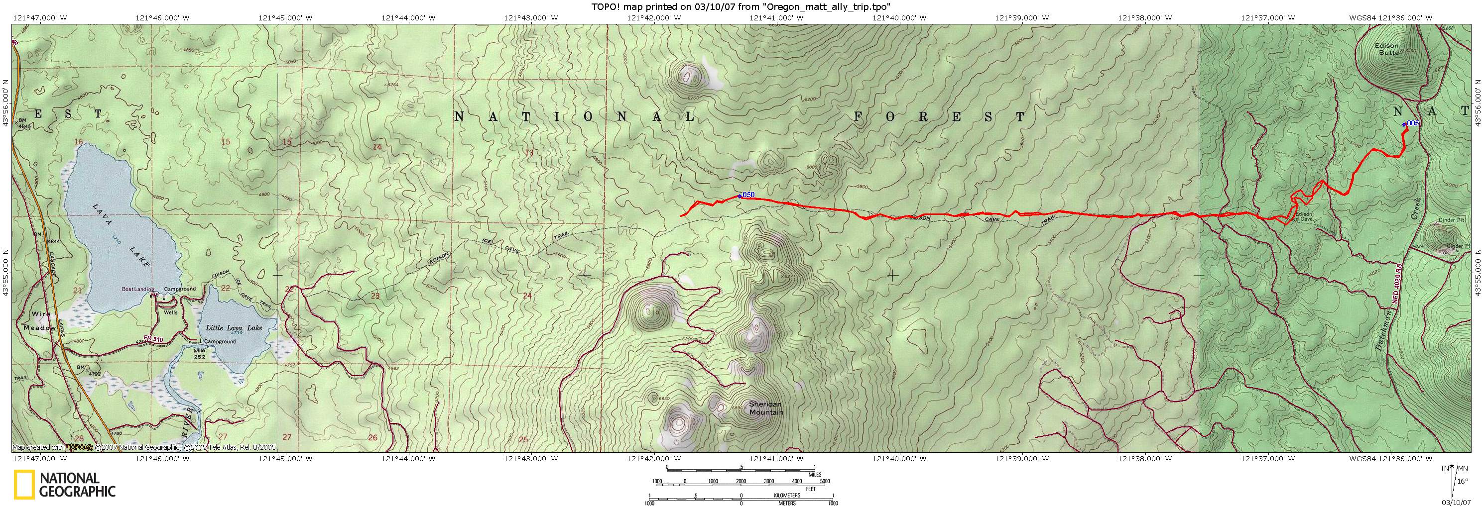
| Topo Trail Map | Map Legend |


|
OR - Edison to Lava Lake - Mountain Bike Trail Review with Map and Pictures - Reviewed By NB and HLM |
|||||||||||||||||||||||||||||||||||||||||||||||||||||||||||||||||||||||||||||
Directions -
Take Highway
46 (Cascade Lakes Highway) out of town toward Mt Bachelor. In about 16 miles
turn left on the Sun river turnoff (FS 45). Go about 6 miles and turn right
into the Edison Sno-Park lot. Park in the south end of the lot at the
mountain bike trailhead. There is a separate ATV trailhead and trails |
Description - A 20 mile out and back to Lava Lake. In the beginning of the trail there was a lot of lava to ride over which was a blast, but then it went to very dry sandy conditions. At a different time of year I’m sure it would be better, but we didn’t go all the way to the lake because of the sand. Climbing in the sand sucks the life out of your legs. The scenery was beautiful as you’re out in the middle of nowhere. We turned around and had a sweet downhill run back to the car despite the sand… Loops -Just follow the signs to Lava Lake. There really is only one mtn bike trail. The rest is all ATV trails. The trail description is on the map “Mountain Biking in Central Oregon”. Pre-ride Music: |
Total Miles: |
Elevation Change Feet - |
|
Disclaimer: Caution - Use this map at your
own risk. Bikerag.com and affiliates will not accept
responsibility for an personal injury, property damage or trespassing while
using this map. Trail users shall obey all signs, and always obtain
permission from the land owner to use trails for any sporting activity.
Permission to use trails should not be assumed. This map simply
contains topographical information and trails that existed at one time.
Trails shown maybe be missing, not accurate, closed, overgrown etc.... |
To
view larger version of map, right click on map and select View Image. |
| ||||||||||||||||||||||||||||||||||||||||||||||||||||||||||||||||||||||