|
|
|
|
| Topo Trail Map | Map Legend | Bikerag Pictures |
|
NY - Shindagin Hollow - Mountain Bike Trail Review with Map and Pictures 30% Preliminary Review!! |
|||||||||||||||||||||||||||||||||||||||||||||||||||||||||||||||||||||||||||||
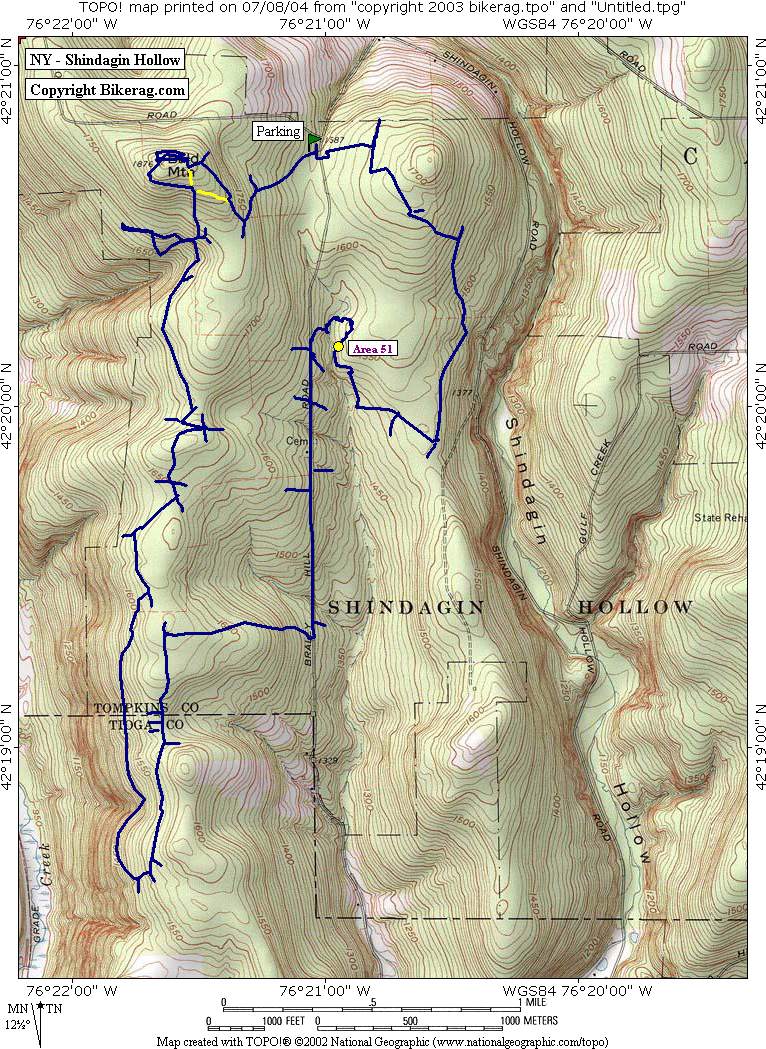
Directions - From 81, take 79 east to Slater
Ville springs, right after downtown take a left on creamery road, take to
end then left onto valley/central chapel road, at Y go right on braley hill
road, 1/2 mile up park on right just after you pass dirt road on right.. |
Description - Heard lots of hype about this place, epic this and epic that.. Had to take a trip and check out the goods.. NOW I only rode 1/3 but this is what I found from what I hit.. Trails are good, but nothing too exciting.. Super buff 1.5 track, some singletrack, lots of wide trails too.. Some logs and roots on the trails but almost zero rocks or technicalities.. But the good news is someone made up for this lack of technicalities and added some sweet stunts in area 51.. Really great stuff, Intermediate stuff that most can ride, not too many drops, log rides, ramps, a-frame, see saw, nice short technical stunt trail.. I think the term epic is over-used.. Kind of like internet dating when a women describes herself as "Petite" that tends to mean short and fat.. Epic to me TYPICALLY means, a long uneventful ride.. I would come back here and check out the rest of the trails if I was in the area.. They are good trails and linked with some stunts can be a good day of riding!! Thanks to the locals that built the goods, some of the best stunts I have seen in my travels, very sturdy.. Thanks!! Please let me know If I just happened to hit all the lame trails and miss the good stuff!! I will post an update if so.. Oh yeah, go to a local bike shop and pick up a trail guide, very impressive map and description, just be careful as its missing a few trails.. Still a steal at $7.00... Pre-ride Music: |
Total Miles: 30?? |
Elevation Change Feet - |
|
Disclaimer: Caution - Use this map at your
own risk. Bikerag.com and affiliates will not accept
responsibility for an personal injury, property damage or trespassing while
using this map. Trail users shall obey all signs, and always obtain
permission from the land owner to use trails for any sporting activity.
Permission to use trails should not be assumed. This map simply
contains topographical information and trails that existed at one time.
Trails shown maybe be missing, not accurate, closed, overgrown etc.... |
To
view larger version of map, right click on map and select View Image. |
| ||||||||||||||||||||||||||||||||||||||||||||||||||||||||||||||||||||||