|
|
|
|
| Topo Trail Map | Map Legend | Bikerag Pictures |
|
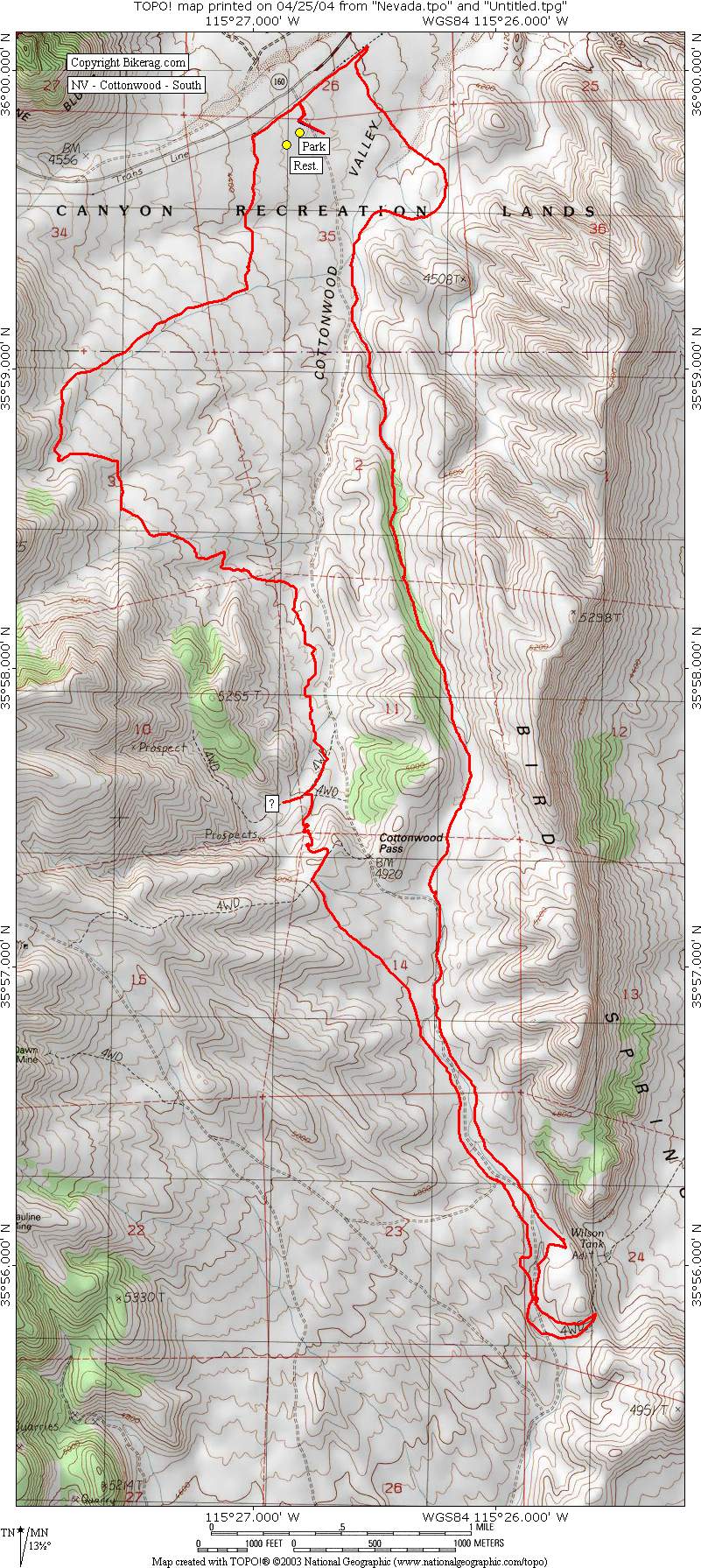
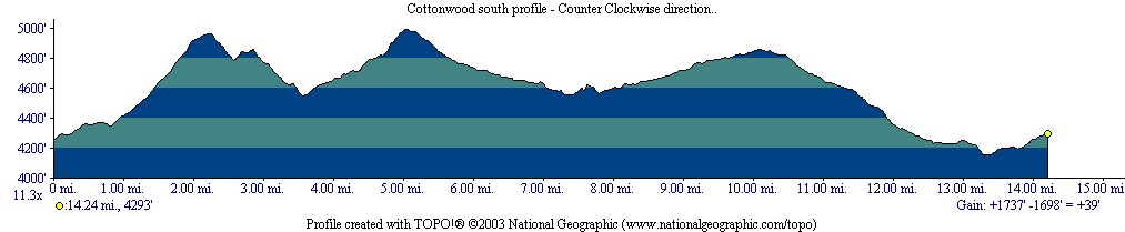
NV - Cottonwood - South - Mountain Bike Trail Review with Map and Pictures |
||||||||||||||||||||||||||||||||||||||||||||||||||||||||||||||||||||||||||||||
Directions - From vegas take Route 15 to Blue
Diamond Parkway Route 160.. After the turn off for 159 on the right,
keep going straight for 5.82 miles and park on left in dirt lot with
bathroom. |
Description - This place is really cool, the loop we took was say 80% single track, some fire road climbing mainly at the start. The loop we did was the Norba loop as described by bike outpost in blue diamond.. Stop by and check in with them for more maps and stuff.. There are a few turns you have to make that are not on the topo map.. We just kept following signs that said (2,3,4) or (2,4), with an arrow and really tried to follow the contours of the landscape.. Your never that far from the access road.. One nice single track climb on the way out is called satans elevator or escalator.. Single track is mainly fast cruisy fun, just one drop on the way back but super fast. Not very technical at all, but a fun loop.. Keep your eyes open for single track!!! Pre-ride Music: |
Total Miles: 35?? |
|
 |
|
Disclaimer: Caution - Use this map at your
own risk. Bikerag.com and affiliates will not accept
responsibility for an personal injury, property damage or trespassing while
using this map. Trail users shall obey all signs, and always obtain
permission from the land owner to use trails for any sporting activity.
Permission to use trails should not be assumed. This map simply
contains topographical information and trails that existed at one time.
Trails shown maybe be missing, not accurate, closed, overgrown etc.... |
To
view larger version of map, right click on map and select View Image. |
| ||||||||||||||||||||||||||||||||||||||||||||||||||||||||||||||||||||||