|
Nova Scotia - Cape Split - Mountain Bike Trail Review with Map and Pictures |
||||||||||||||||||||||||||||||||||||||||||||||||||||
|
||||||||||||||||||||||||||||||||||||||||||||||||||||
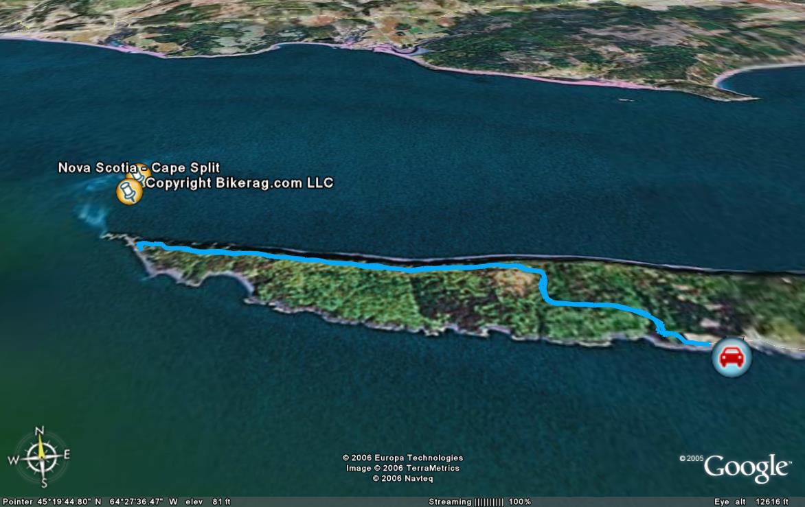
| Directions - If you cant find this ride, you
are officially hopeless.. Ill tell you anyway - from Halifax, take 101
to 358, follow signs for scotts bay, at the very end, there is a parking
area, trailhead is right freakin there.. Description - Nice view of the ocean from the parking area, then its into the woods, might have to walk some, muddy rock garden next to barbed wire, ends shortly, then rooty double track, to fire road uphill - mixed bag - some rock, some roots, up up up... There is one right FORK, dont take it, just stay straight.. As you go up, there are many little side tracks around mud sections, towards the top, it gets more single track, more rooty, more fun.. Top there is a sick view, really really worth the ride which will only take you 40 minutes .. Hang out, take some pics, take a piss, return ride home is lots of fun, up and down, then mainly downhill, 30 min or so.. Some side trails lead to views I assume .. This is a tourist attraction, so avoid it on the weekends, I hear night riding with a carbo loading at the view is a local treat... Loops - Its not a loop, its not a loop, im telling you its an out and back, I wont even waste rookies precious web space on a map.. |
||||||||||||||||||||||||||||||||||||||||||||||||||||
| Pre-ride Music: Toad the wet sproket - Walk on the ocean, making me look more gay than ever.. | ||||||||||||||||||||||||||||||||||||||||||||||||||||
| Total Miles: | ||||||||||||||||||||||||||||||||||||||||||||||||||||
| Elevation Change Feet - | ||||||||||||||||||||||||||||||||||||||||||||||||||||
|
||||||||||||||||||||||||||||||||||||||||||||||||||||
| Disclaimer: Caution - Use this map at your own risk. Bikerag.com and affiliates will not accept responsibility for an personal injury, property damage or trespassing while using this map. Trail users shall obey all signs, and always obtain permission from the land owner to use trails for any sporting activity. Permission to use trails should not be assumed. This map simply contains topographical information and trails that existed at one time. Trails shown maybe be missing, not accurate, closed, overgrown etc.... | ||||||||||||||||||||||||||||||||||||||||||||||||||||
| To view larger version of map, right click on map and select View Image. | ||||||||||||||||||||||||||||||||||||||||||||||||||||
|
||||||||||||||||||||||||||||||||||||||||||||||||||||


