|
|
|
|
| Bikerag Trail map Get a free map at the bike shop! Or Use this online Map |
Map Legend |


|
|
|
|
| Bikerag Trail map Get a free map at the bike shop! Or Use this online Map |
Map Legend |
|
South Foothills - Albuquerque New Mexico - Mountain Bike Trail Review with Map and Pictures
Preliminary Review - Just One Visit |
||||||||||||||||||||||||||||||||||||||||||||||||||||
|
||||||||||||||||||||||||||||||||||||||||||||||||||||
| Directions - From route 40 take tramway north,
right on copper ave, park at end. ( or for a larger lot - tramway
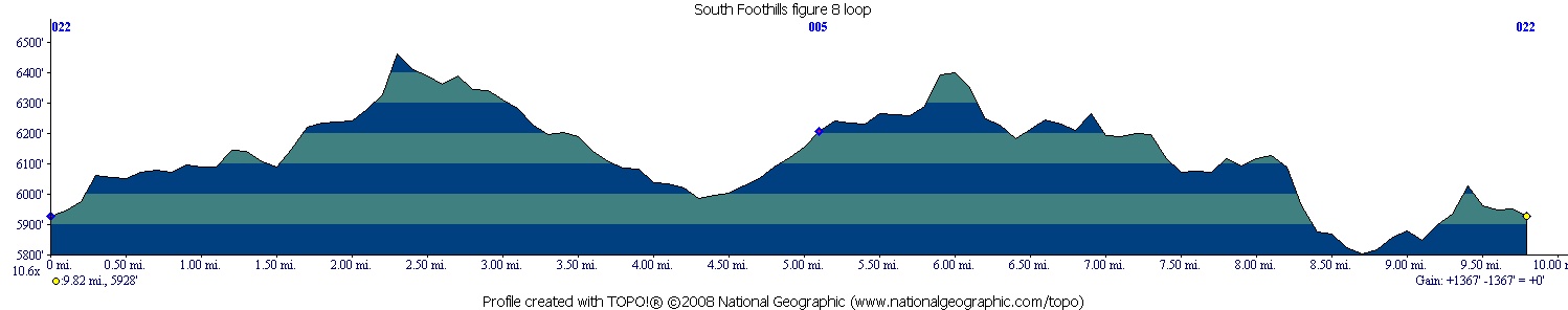
north to right on indian school, follow to end. Description - The south foothills area is a great trail system conveniently located on the eastern edge of Albuquerque under the Sandia mountains. Although most of the trail is buff, there are a some nice technical obstacles if you look hard enough. We found a few nice drops, jumps and rollers. The trail ranged from singletrack to 3 track. Basically any trail that is flat, is wide.. Trails that are bench cut around the terrain are nice tight singletrack. This is a multi-use trail system that can be crowded at times with hikers and other mountain bikers but mid week the place was pretty empty. Nice views of the sandia's can be had through the whole ride. There are many side trails that are not located on the map, you really have ot get a feel for the area to figure out which trail to take, but we did fine following our general direction and trying to stay on singletrack. Often the extra singletrack trails had some nice lines on them.. Also check out the power lines trails off 365! Looked like some killer steep technical lines in there, but too tired to check them out. Always have to save something for next time. This area reminds me of the lunch loops in grand junction, only not near as technical. Loops - The loop we did worked out great for this area basically a figure 8. From Copper ave parking area take 401 north, right on 365a, left on 365, eventually left on 401 back to Indian school parking area, to 365a (again), then right on 365, ALL the way to the end, right on road, then you can jump back on 401 north at 90 degree bend in road, back to car. |
||||||||||||||||||||||||||||||||||||||||||||||||||||
| Pre-ride Music: | ||||||||||||||||||||||||||||||||||||||||||||||||||||
| Total Miles: 15 ish?? | ||||||||||||||||||||||||||||||||||||||||||||||||||||
|
Elevation Change Feet - 1367
|
||||||||||||||||||||||||||||||||||||||||||||||||||||
|
||||||||||||||||||||||||||||||||||||||||||||||||||||
| Disclaimer: Caution - Use this map at your own risk. Bikerag.com and affiliates will not accept responsibility for an personal injury, property damage or trespassing while using this map. Trail users shall obey all signs, and always obtain permission from the land owner to use trails for any sporting activity. Permission to use trails should not be assumed. This map simply contains topographical information and trails that existed at one time. Trails shown maybe be missing, not accurate, closed, overgrown etc.... | ||||||||||||||||||||||||||||||||||||||||||||||||||||
| To
view larger version of map, right click on map and select View Image.
|
||||||||||||||||||||||||||||||||||||||||||||||||||||