|
|
|
|
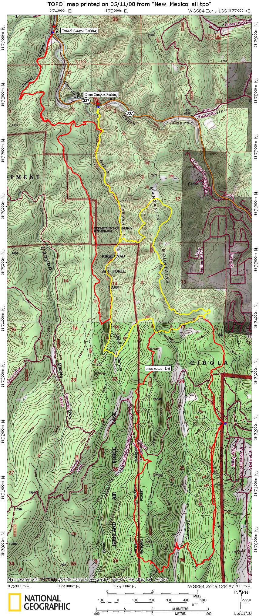
| Trail map - Not Complete, Not near complete | Map Legend |


|
|
|
|
| Trail map - Not Complete, Not near complete | Map Legend |
|
Otero Canyon / Tunnel Canyon - New Mexico Mountain Bike Trail Review with Map and Pictures
Preliminary Review - Just One Visit. |
||||||||||||||||||||||||||||||||||||||||||||||||||||
|
||||||||||||||||||||||||||||||||||||||||||||||||||||
| Directions - From Albuquerque take 40
east to Tijeras, take exit for 337 south. Tunnel Canyon Parking is 2.5 miles
down the road, Otero Canyon parking is an additional 1.25 miles. Both
Lots are on right side of road. Description - First off, I would suggest getting a tour of this area from a local (like we did - thanks RCC!). There are many unmarked trails and a nearby military boundary (Kirkland Air force base) that is a bit of a grey area at this time. According to one of the rangers, the military has agreed to "give back" some of the land but it is unclear as to how much and when this will happen. Currently there are no-trespassing sings at the military boundary. The terrain at Otero was very cool, mainly singletrack with some fun rock lines, rollers & drops. We even found a pretty worthy log ride en-route. Some loose stuff but nothing that hindered the climb or descent too much. There were a few really nice techy rock sections with multiple lines. Many Many more trails to explore in the area, to start with, if you wish for more miles park at tunnel canyon and get into Otero from there. For even larger rides you can link up with the Cedro Peak trail system that has hundreds of miles of trails. Loops - |
||||||||||||||||||||||||||||||||||||||||||||||||||||
| Pre-ride Music: | ||||||||||||||||||||||||||||||||||||||||||||||||||||
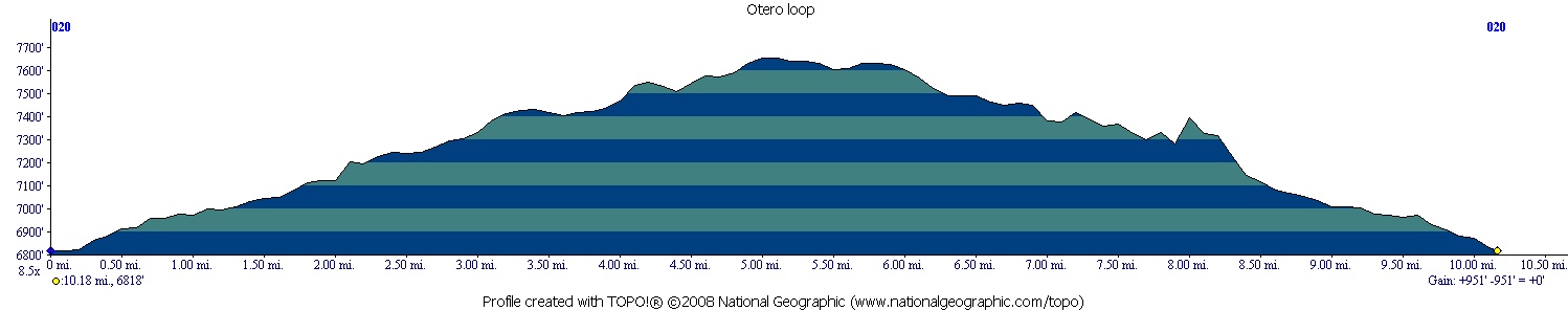
| Total Miles: | ||||||||||||||||||||||||||||||||||||||||||||||||||||
|
Elevation Change Feet - 951
|
||||||||||||||||||||||||||||||||||||||||||||||||||||
|
||||||||||||||||||||||||||||||||||||||||||||||||||||
| Disclaimer: Caution - Use this map at your own risk. Bikerag.com and affiliates will not accept responsibility for an personal injury, property damage or trespassing while using this map. Trail users shall obey all signs, and always obtain permission from the land owner to use trails for any sporting activity. Permission to use trails should not be assumed. This map simply contains topographical information and trails that existed at one time. Trails shown maybe be missing, not accurate, closed, overgrown etc.... | ||||||||||||||||||||||||||||||||||||||||||||||||||||
| To
view larger version of map, right click on map and select View Image.
|
||||||||||||||||||||||||||||||||||||||||||||||||||||