|
|
|
|
| Topo Trail Map | Map Legend |


|
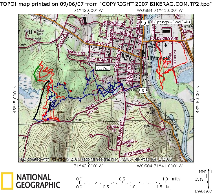
NH - Fox Park in plymouth - Mountain Bike Trail Review with Map and Pictures Preliminary Review 1 visit. |
|||||||||||||||||||||||||||||||||||||||||||||||||||||||||||||||||||||||||||||
Directions - Route 93, exit 25, head towards
Plymouth center, take left, end of town, couple streets after Right Aid take
a right (Warren Street I think), head uphill, second right on Langdon,
you'll see the park on your left. |
Description - This place is a gem. Can't believe it took me so long to check out. Variety of trails in the park area ranging from doubletrack to nice tight flowing singletrack. When you find the trail with orange flags your in for a fun ride. Very good mix of trails from twisty to flowy, with minor to moderate tech's here and there. Not too freeride, but super fun technical XC.. Ill be back to check out more of this awesome trail system. Special thanks to the builders / maintainers - really nice trail work everywhere.. Update 2007 - Found lots more singletrack here.. Amazing trail work, very twisty ( I actually got dizzy).. Some good tech stuff here and there, few rollers, small drops.. All in all, a great place for XC. Loops - Pre-ride Music: |
Total Miles: |
Elevation Change Feet - |
|
Disclaimer: Caution - Use this map at your
own risk. Bikerag.com and affiliates will not accept
responsibility for an personal injury, property damage or trespassing while
using this map. Trail users shall obey all signs, and always obtain
permission from the land owner to use trails for any sporting activity.
Permission to use trails should not be assumed. This map simply
contains topographical information and trails that existed at one time.
Trails shown maybe be missing, not accurate, closed, overgrown etc.... |
To
view larger version of map, right click on map and select View Image. |
| ||||||||||||||||||||||||||||||||||||||||||||||||||||||||||||||||||||||