|
|
|
|
| Trail map | Map Legend |


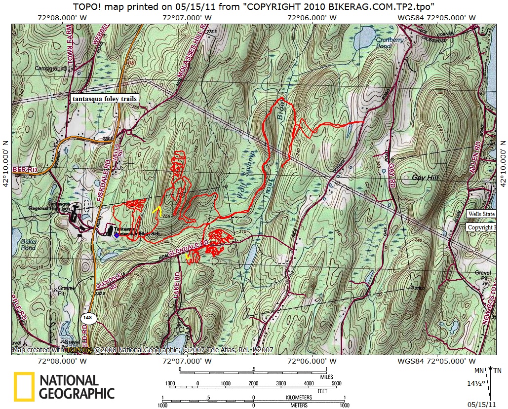
| Tantasqua Foley Jr HS - Mountain Bike Trail Review with Map and Pictures | ||||||||||||||||||||||||||||||||||||||||||||||||||||
|
||||||||||||||||||||||||||||||||||||||||||||||||||||
| Directions - take 84 to route 20 West to 148
north and look for tantasqua school on your right. Trailhead is by the
basketball court. Description - Stumbled on this place while browsing gpx tracks near wells state park and thought Hmmm that looks like singletrack made for mountain biking. Rolled the dice and checked it out. Very cool trails in a small area (yet not overly twisty), all tight singletrack with nice flow, some natural features and no trail braids! The trails up on the hill are VERY directional. You want to take a left after the pallet bridge and go UP on that side, otherwise hike a bike. A few new trails in there too! I did not see any no trespassing signs so it seems like this place is legit. Let me know if otherwise! Loops - |
||||||||||||||||||||||||||||||||||||||||||||||||||||
| Pre-ride Music: | ||||||||||||||||||||||||||||||||||||||||||||||||||||
| Total Miles: 12 ish | ||||||||||||||||||||||||||||||||||||||||||||||||||||
| Elevation Change Feet - | ||||||||||||||||||||||||||||||||||||||||||||||||||||
|
||||||||||||||||||||||||||||||||||||||||||||||||||||
| Disclaimer: Caution - Use this map at your own risk. Bikerag.com and affiliates will not accept responsibility for an personal injury, property damage or trespassing while using this map. Trail users shall obey all signs, and always obtain permission from the land owner to use trails for any sporting activity. Permission to use trails should not be assumed. This map simply contains topographical information and trails that existed at one time. Trails shown maybe be missing, not accurate, closed, overgrown etc.... | ||||||||||||||||||||||||||||||||||||||||||||||||||||
| To view larger version of map, right click on map and select View Image. | ||||||||||||||||||||||||||||||||||||||||||||||||||||
Copyright by Bikerag.com, LLC. All rights reserved.