|
|
|
|
| Topo Trail Map | Map Legend | Bikerag Pictures |
|
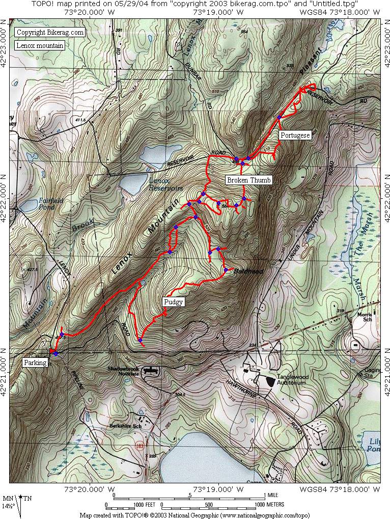
MA - Lennox Mountain - Mountain Bike Trail Review with Map and Pictures |
|||||||||||||||||||||||||||||||||||||||||||||||||||||||||||||||||||||||||||||
Directions - Mass Pike East, exit 1, right at
exit, 50 feet, left turn clyde, .37 miles you drive through the quant town
of west stockbridge and take a right on Lennox Street, follow lennox street
2 miles to end and take right on lennox road, .1 miles take right into small
parking area, trail head is across the street.. Nice view of a lake and a
bowl.. |
Description - Lennox mountain has some sweet singletrack pleasures - Some moderate technical rocky sections, some rock slab, extended trails with super dizzy fun twisty turny switchbacks riddled with some logs and 1.1 footers.. Not without penalty, there's some climbing here, the loop we did hit all the climbs on fire roads which was pretty sleazy.. This is a great XC ride, loved it.. Pre-ride Music: Kill
Bill soundtrack |
Total Miles: |
Elevation Change Feet - Our 8 mile loop was 1200
vertical!! Dats alot |
|
Disclaimer: Caution - Use this map at your
own risk. Bikerag.com and affiliates will not accept
responsibility for an personal injury, property damage or trespassing while
using this map. Trail users shall obey all signs, and always obtain
permission from the land owner to use trails for any sporting activity.
Permission to use trails should not be assumed. This map simply
contains topographical information and trails that existed at one time.
Trails shown maybe be missing, not accurate, closed, overgrown etc.... |
To
view larger version of map, right click on map and select View Image. |
| ||||||||||||||||||||||||||||||||||||||||||||||||||||||||||||||||||||||