|
|
|
|
| Bikerag -
Topo Map of Area NEW - Detailed Aerial photo map - THANKS Splatt |
Map Legend | Bikerag Pics |


|
|
|
|
| Bikerag -
Topo Map of Area NEW - Detailed Aerial photo map - THANKS Splatt |
Map Legend | Bikerag Pics |
|
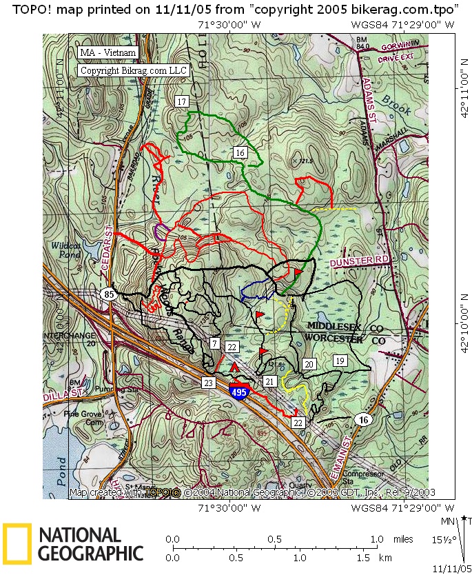
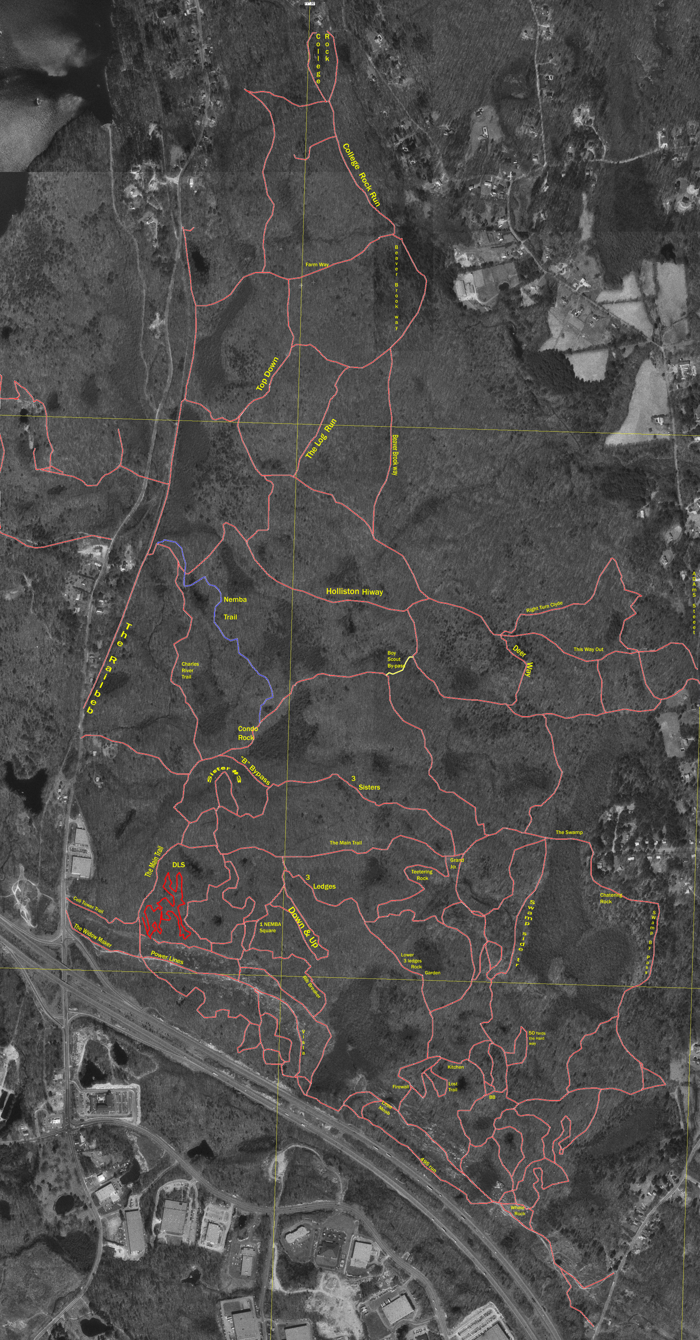
MA - Vietnam - Mountain Bike Trail Review with Map and Pictures |
||||||||||||||||||||||||||||||||||||||||||||||||||||||||||||||||||||||||
 |
||||||||||||||||||||||||||||||||||||||||||||||||||||||||||||||||||||||||
Directions - By
car, take Rt. 495 to exit #20 (Rt 85/Milford). If coming from Rt 495 South,
go right at end of ramp onto Rt 85 South. If coming from Rt 495 North, go
left at end of ramp onto Rt 85 South. Take Rt 85 south approximately 1 mile.
There is a municipal parking lot at the ball fields.
|
Update 2008 - Nam has undergone quite the transformation in the past several years after the Nemba land purchase. 2 or 3 very nice free-ride trails (Rubber stamp, DLS) have popped up and showcase some amazing trailwork . Everything flows great, lots of moderate hits, all nice transitions, unique lines. Great place go practice hucks, or a nice XC ride. THe new nemba XC trail is really nice too, but noticed quite a bit of ATV use on it the other day. Description - Pretty much one stop shopping here for all your biking needs. Some good singletrack, great rocky sections, pretty flat, occasional bike stunts, including a big ramp and crazy rocks under the power lines.. Can be pretty busy at times. Some motorcycles. Bring a change of underwear. Pre-ride Music: U2
- war, Praga khan - my mind is the enemy |
Total Miles: 20 ish |
Elevation Change Feet - Elevation
Profile |
|
| |||||||||||||||||||||||||||||||||||||||||||||||||||||||||||||||||||


