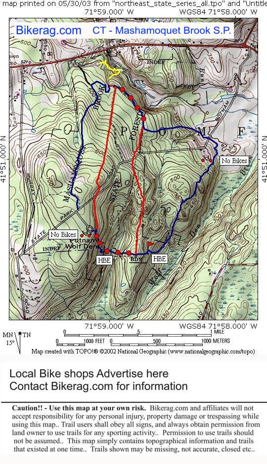
| Directions - Take 44 East, past abington, look
for park signs on right.. THere is no Parking at the campground,
so go past this sign down hill and take a right into the actuall park..
The trailhead however is at the campground!!! So you have to
pedal back up the pavement, unless you want to get wet.. Real wet.. Description - This
place was feast or famine for mountain biking.. Basically a mix of
everything you can imagine, just not a GOOD mix.. Some super
wide buff 4x track, some thinner buff 2x track, some semi rooty single
track, some fern lined singletrack, some rocky single track, some muddy ST,
some rocky muddy ST, some slickrock, some sick downhills that I hiked up,
some sick downhills I hiked down.. Mix in some no bikes signs for good
measure and you have a totally retarted ride (not that there is anything
wrong with that).. One cool 30 foot slick steepish down, many park
style bridges, couple 1 and 2 footers.. Yeah I tucked my balls in my
purse and walked those TOO..
Basically the blue trail south of wolf den drive was very technical
but with a couple HBE's (hike a bike extreme).. Some cool landmarks
like indian chair, wolf den, table rock... red trails were all
lame and uneventfull..
|


