|
CT - Meshomasic - Mountain Bike Trail Review with Map and Pictures |
|||||||||||||||||||||||||||||||||||||||||||||||||||||||||||||||||||||||||
 |
|||||||||||||||||||||||||||||||||||||||||||||||||||||||||||||||||||||||||
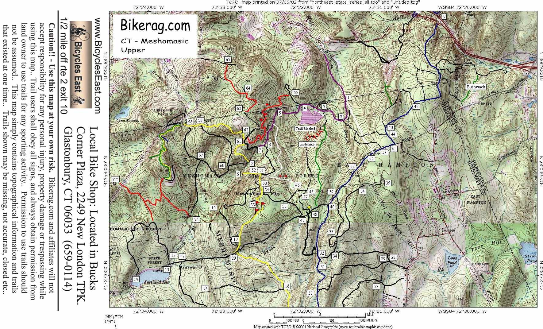
Directions - take rte 2 south to exit 10
country club road,right at exit, drive 50 feet, left at stop, take right at
first stop sign (there is a green sign for glastonbury hills country club),
go down hill, up hill, left onto mott hill (strait is dead end), follow mott
hill until it turns to dirt, then follow for like another 1-2 miles and park
were there is a green gate on left and reservoir on left, if you pass a
yellow gate on your right you have gone too far (unless of course you are
meeting at the yellow gate!) |
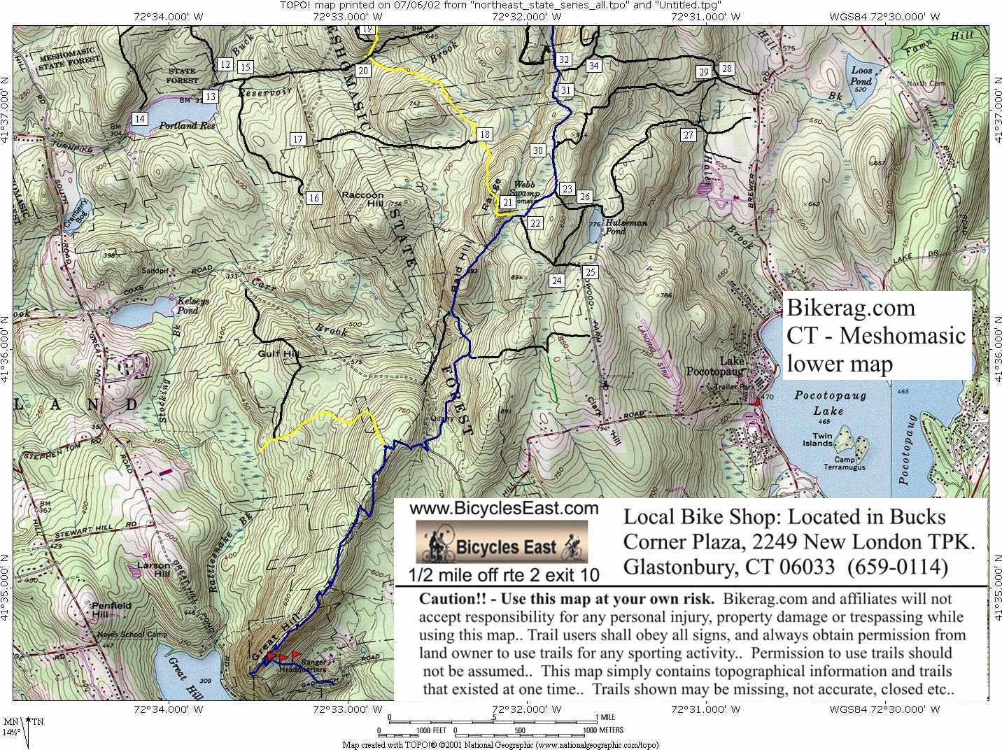
Description - Meshomasic state forest in the Marlboro area is by far one of the best riding areas in CT. A huge variety of terrain ranging from winding single track to rocky fire roads, to rocky technical sections can be found. There are also some killer climbs and raging LONG downhill sections. I suggest you check out one of the loops in the link above. Loops-Pukemaster Standard (11 miles) Pre-ride Music: Crystal
method - trip like I do |
Total Miles: Im too tired to add
them up - Say 43 miles?? |
Elevation Change Feet - 1000 to 2000 depending
upon who you are following.. |
Nearest Coffee, Sushi or other food: DD or
Coffee Roasters - take rte 2 north, exit 8, left at exit, under highway,
through 2 lights dd on right, continue to main street, Coffee Roasters is on main
street either right or left, not sure but its only 50 feet away from the
intersection and you can probably smell your way there you freakin addict.. Nearest Sushi - Shogun in glastonbury, or if you ride mesh. from the other side, mikado in
middletown is reall close |
| ||||||||||||||||||||||||||||||||||||||||||||||||||||||||||||||||||||


