|
|
|
|
| Trail map
Mobile maplets - gps enabled map |
Map Legend | - Post a Picture and view Posted Pictures |


|
|
|
|
| Trail map
Mobile maplets - gps enabled map |
Map Legend | - Post a Picture and view Posted Pictures |
| Mooween State Park - Mountain Bike Trail Review with Map and Pictures | ||||||||||||||||||||||||||||||||||||||||||||||||||||
|
||||||||||||||||||||||||||||||||||||||||||||||||||||
|
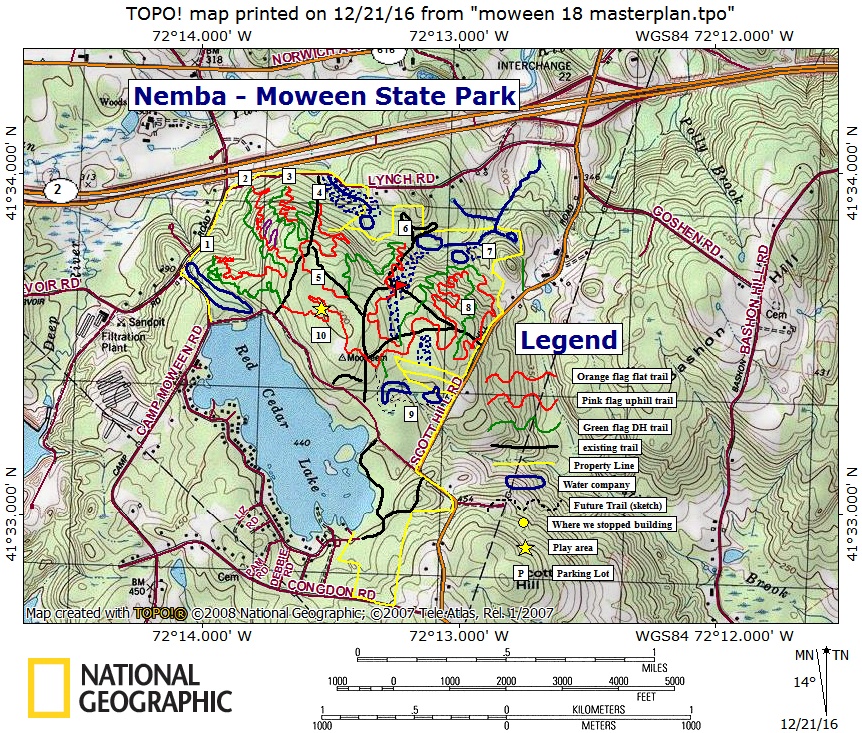
Description - Mooween state park is a brand new trail system created by NEMBA with approval of the DEEP. The trails are laid out in one main loop with directional trails descending and ascending. The climbs and decents were kept as long as possible while utilizing the natural terrain which Mooween has plenty of. All natural drops and jumps have go arounds, but the trail is moderately technical. There are also many bail spots if you wish to ride a shorter loop. See map for intersection of new singletrack vs existing trail. History - The Polaroid camera was invented at Mooween. Loops - |
||||||||||||||||||||||||||||||||||||||||||||||||||||
| Pre-ride Music: Juno Reactor - swamp thing | ||||||||||||||||||||||||||||||||||||||||||||||||||||
| Total Miles: 9.6 singletrack + maybe 4 of existing doubletrack | ||||||||||||||||||||||||||||||||||||||||||||||||||||
| Elevation Change Feet - 999 | ||||||||||||||||||||||||||||||||||||||||||||||||||||
|
||||||||||||||||||||||||||||||||||||||||||||||||||||
| Disclaimer: Caution - Use this map at your own risk. Bikerag.com and affiliates will not accept responsibility for an personal injury, property damage or trespassing while using this map. Trail users shall obey all signs, and always obtain permission from the land owner to use trails for any sporting activity. Permission to use trails should not be assumed. This map simply contains topographical information and trails that existed at one time. Trails shown maybe be missing, not accurate, closed, overgrown etc.... | ||||||||||||||||||||||||||||||||||||||||||||||||||||
| To
view larger version of map, right click on map and select View Image.
|
||||||||||||||||||||||||||||||||||||||||||||||||||||