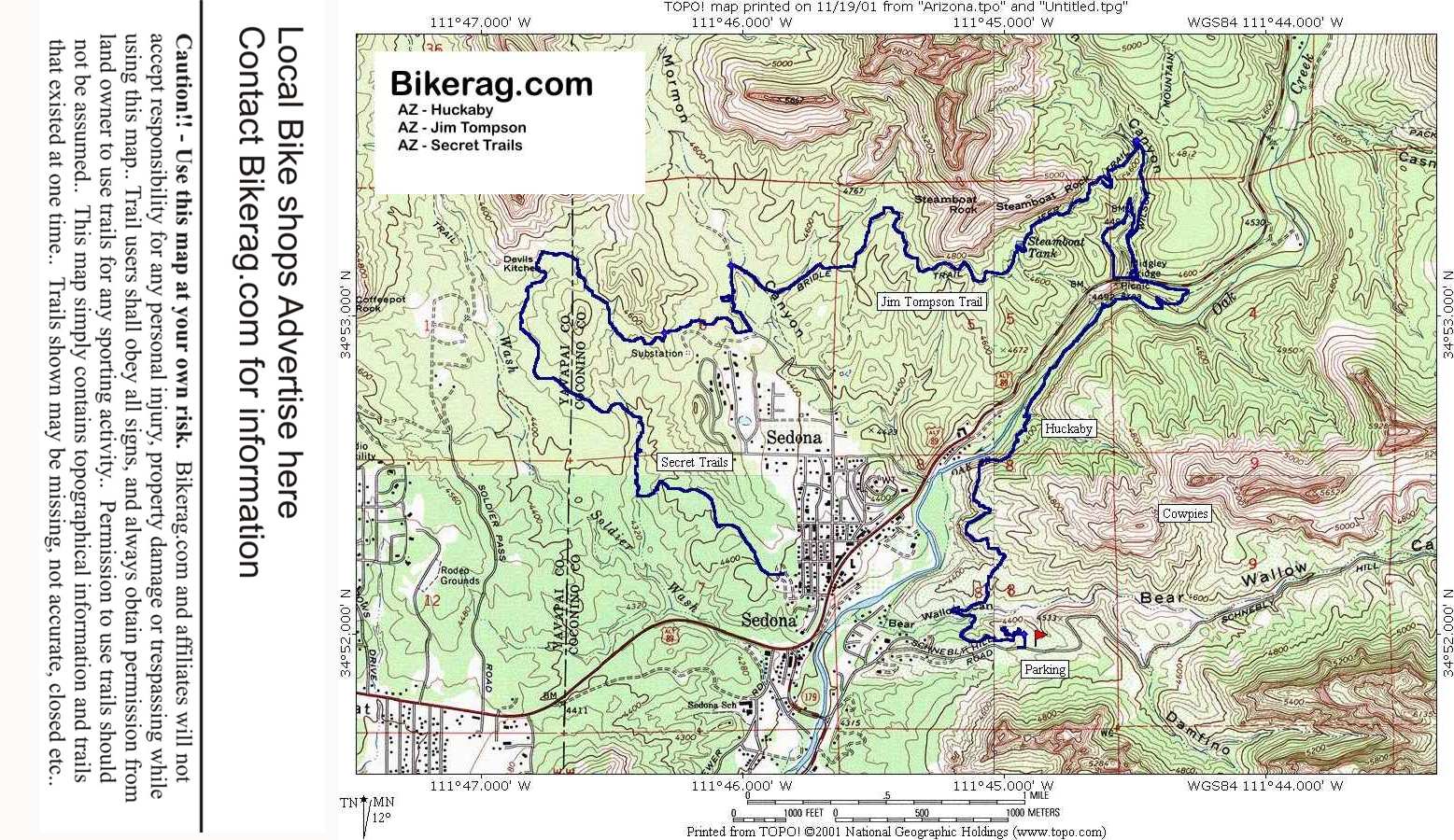
Topo Map of Area Map Legend Bikerag Pics

Post a Picture and view Posted Pictures


Az - Jim Tompson - Mountain Bike Trail Review with Map and Pictures

Category:

Overall Rating in Buckets

Adventure Climbing Free-ride Fun Fear      Trail Enhancements Scenery Technicalities
1 1 1 2.9 1.5 0 3 3.1 3.25
GPS  Files - (Contact Bikerag To Upload Your files)
Google Earth GPX Map File GPX Routes Other
  jimtompson.gpx    
       
For PERSONAL use only - Please read our GPS info page
Description - Start at the tourist parking next to bridge.  Second right onto wilson trail follow and take a left onto jim tompson.  Jim wilson was killed by a grizzly BTW.  SO watch out.  Jim tompson is a loose rock fire road, decently hard climb with loose rocks, Trail splits, dont think it matters wich way you go, we went right, be adventurous..  Flat fast then downhill cool rocky fast with great big rocks above you..  Look for monkey boy rock and big nose mountain, and laptop on stomach mountain - You got it named by bikerag..  Continue on secret trails if you like..
Pre-ride Music:  The doors - Break on Thru
Total Miles:  5
Elevation Change Feet - Elevation Profile
Local Bike Shops  Advertise Here !!
Lodging Temp Remove Lodging Add
Restaurants Advertise Here !!
Local Websites Advertise Here !! - Free Links may be applicable..  Just Ask..
Land Manager & other Info Contact Bikerag - To update land manager info.
Related Guide Books & Mapping Software  Mountain Bike Guide Books - Used & New

 Topo Software for all states - Used & New

Copyright  by Bikerag.com, LLC.  All rights reserved.