|
|
|
|
| Trail map | Map Legend |


| Roaring Creek state forest, Aristes PA - Mountain Bike Trail Review with Map and Pictures | ||||||||||||||||||||||||||||||||||||||||||||||||||||
|
||||||||||||||||||||||||||||||||||||||||||||||||||||
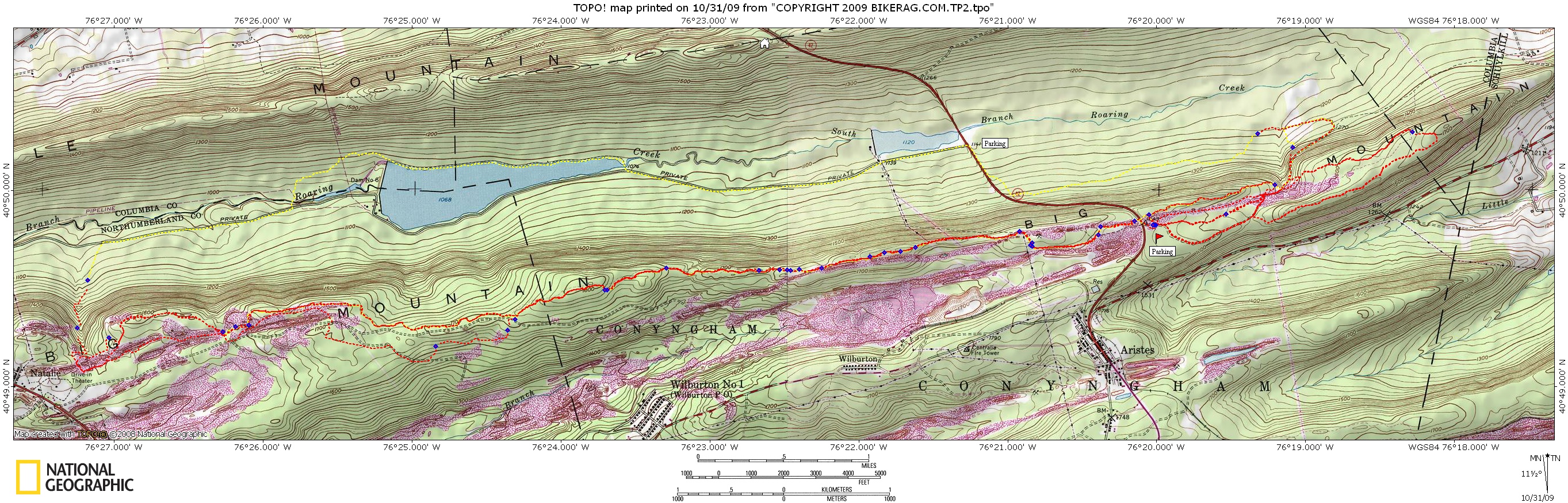
| Directions - From 80 take 42 south toward
Aristes PA. Before you reach Aristes 42 will crest a hill, take
a left into parking area. Description - A nice mix of mild and moderate technical trails. We only had time to hit the north side of 42, there was some logging going on the south side so the start of the trail was confusing. Looks like you can do a big loop on the south side though. Map was compiled from motionbased tracks so no idea if the trails exist, but they usually do. Found a nice drop 50 ft from the car but it was the only drop we found on the limited trails we hit. Well maintained area for sure, lots of pavers where needed. Loops - |
||||||||||||||||||||||||||||||||||||||||||||||||||||
| Pre-ride Music: | ||||||||||||||||||||||||||||||||||||||||||||||||||||
| Total Miles: | ||||||||||||||||||||||||||||||||||||||||||||||||||||
| Elevation Change Feet - | ||||||||||||||||||||||||||||||||||||||||||||||||||||
|
||||||||||||||||||||||||||||||||||||||||||||||||||||
| Disclaimer: Caution - Use this map at your own risk. Bikerag.com and affiliates will not accept responsibility for an personal injury, property damage or trespassing while using this map. Trail users shall obey all signs, and always obtain permission from the land owner to use trails for any sporting activity. Permission to use trails should not be assumed. This map simply contains topographical information and trails that existed at one time. Trails shown maybe be missing, not accurate, closed, overgrown etc.... | ||||||||||||||||||||||||||||||||||||||||||||||||||||
| To
view larger version of map, right click on map and select View Image.
|
||||||||||||||||||||||||||||||||||||||||||||||||||||