|
|
|
|
| Topo Trail Map | Map Legend | Bikerag Pictures |


|
NH - Greeley Ponds - Mountain Bike Trail Review with Map and Pictures |
||||||||||||||||||||||||||||||||||||||||||||||||||||||||||||||||||||||||||||
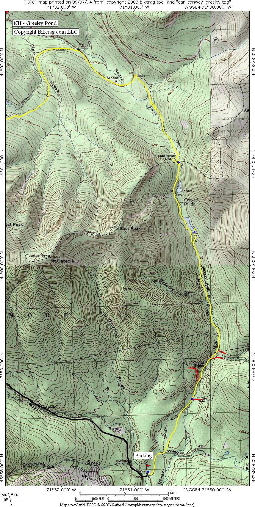
Directions - from I-93N, take exit 28 -
Campton-Thornton-Waterville Valley. Head east on Route 49 to Waterville
Valley. Once at WV take left onto Tripoli Road. After 1 mile
bear right at Y intersection and follow signs to Livermore road trailhead
and park.. - for alternate loop you could park at Greeley Pond trailhead off
the Kancamagus Hwy (NH 112). |
Description - Out and back to Greeley Pond - Starting on livermore road the trail is as wide and buff and flat as you can get.. After .5 miles go left on Greeley Ponds. the trail starts harmless enough on semi rocky double, eventually it follows stream and turns narrower and rooty.. Super rooty in parts.. Couple nice rock sections, several trails can be seen on right and left, well marked.. up to greeley pond the XC trail dead ends.. Great views of the surrounding mountains.. Turn around and head back if you like or continue to the kancamangus highway.. Pre-ride Music: anything by Rustic
Root |
Total Miles & elevation in feet:: out and
back to Greeley Ponds - 6 miles, 640 ft climb /out and back to Kank - 11.4
miles, 800 ft climb. |
|
|
Disclaimer: Caution - Use this map at your own risk. Bikerag.com and affiliates will not accept responsibility for an personal injury, property damage or trespassing while using this map. Trail users shall obey all signs, and always obtain permission from the land owner to use trails for any sporting activity. Permission to use trails should not be assumed. This map simply contains topographical information and trails that existed at one time. Trails shown maybe be missing, not accurate, closed, overgrown etc.... To
view larger version of map, right click on map and select View Image. |
| ||||||||||||||||||||||||||||||||||||||||||||||||||||||||||||||||||||||