


|
NH - Bear Brook - Mountain Bike Trail Review with Map and Pictures |
||||||||||||||||||||||||||||||||||||||||||||||||||||||||||||||||||||||||
 |
||||||||||||||||||||||||||||||||||||||||||||||||||||||||||||||||||||||||
Directions - |
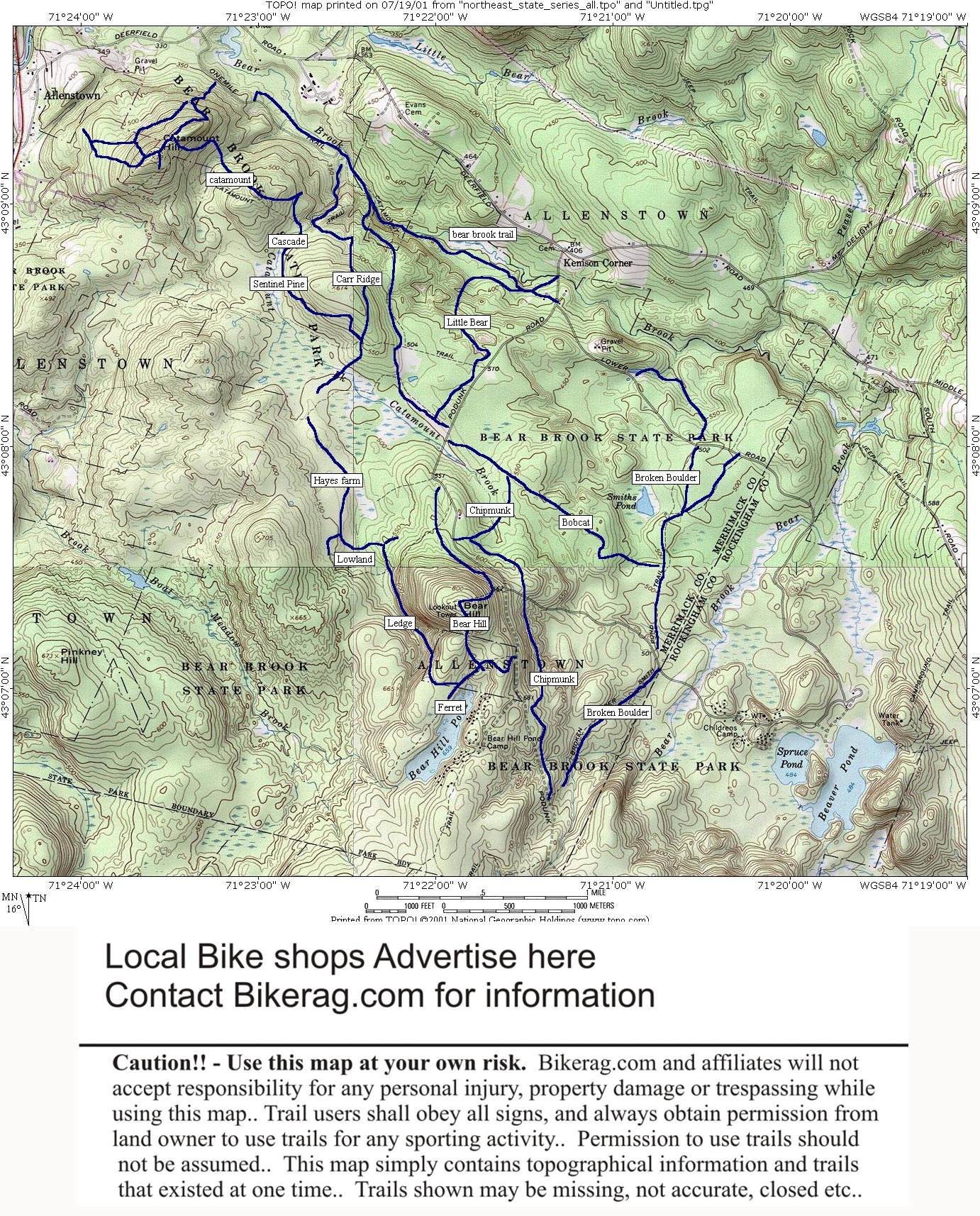
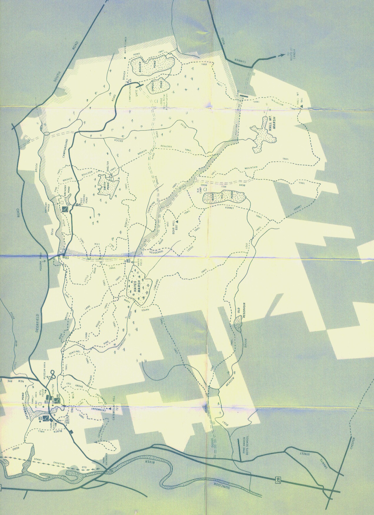
Description - A huge area of riding to be surfed here. Double track, single track, great views, some fast single track and some scattered technical sections. A fee of 3$ is required to keep the rif raf out of the forest. Well marked trails, but don't follow the yellow or orange Eastern Fat Tire routes - they suck.. Just check out ledges, cascade, ridge trail, catamount and try to stay off that evil double track.. Watch out for the millions of chipmunks running ahead in the trail or you'll be pulling them out of your spokes (like I did).. Loops - Here you go - take one mile trail, to lane trail, left on little bear trail (sweet fast downhill), salt lick (easy) left on bobcat, right on broken boulder, right on chipmunk (some good stuff), follow chipmunk to end, left on bobcat, left on road, right on hedgehog, left on ledge (great trail), left on ferret, left on bear hill (follow bear hill up to peak then down fire road, look for single track on left which is the continuation of bear hill) - single track on bear hill is sweet!, left on hedgehog (yes again - sorry), right on lowland, to hays farm, then take sentinel pine trail (great) OR Carr ridge trail (awesome) to cascade trail, follow cascade to catamount, do the loop at the top, then take the unmarked route that on the sign says "to picnic area" back to one mile trail.. That last trail downhill is awesome rocks, drops swoopy stuff!! Take one mile back to the car. If you have any good loops here let me know!! Pre-ride Music: ween - flies
on my dick (the black ones) |
Total Miles: 35 ish?? |
Elevation Change Feet - 1500 per trip or so.. |
|
| |||||||||||||||||||||||||||||||||||||||||||||||||||||||||||||||||||


